

- Usage in publication:
-
- Klamath River Conglomerate Member*
- Modifications:
-
- Named
- Dominant lithology:
-
- Conglomerate
- Sandstone
- Siltstone
- Mudstone
- AAPG geologic province:
-
- Klamath Mountains province
Summary:
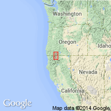
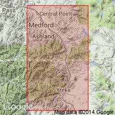
Is lowermost member of Hornbrook Formation. Named for outcrops along Klamath River about 4 km south of Hornbrook. Type section designated about 0.4 km west of Klamath River in old open cut mine west of southbound lane of HWY I-5 about 0.7 km southeast of McCavick mine [S/2 SE/4 sec.32 T47N R6W, Hornbrook 15' quad, Siskiyou Co, CA]. Consists of brown- and red-weathering gray conglomerate with sandstone, siltstone, mudstone, and basal breccia that rests locally on a paleosol. Is as much as 90 m thick (36.5 m thick at type) but laterally discontinuous. Unconformably overlies pre-Cretaceous igneous and metamorphic rocks; conformably underlies Osburger Gulch Sandstone Member (new). Considered to be early Late Cretaceous age based on stratigraphic relations.
Source: GNU records (USGS DDS-6; Menlo GNULEX).
- Usage in publication:
-
- Klamath River Conglomerate Member*
- Modifications:
-
- Age modified
- Overview
- AAPG geologic province:
-
- Klamath Mountains province
Summary:
No fossil or radiometric ages have been determined for Klamath River Conglomerate Member of Hornbrook Formation. However ages of felsic plutons on which unit rests suggest age must be post-Jurassic. Overlying Osburger Gulch Sandstone Member of Hornbrook Formation is late Albian(?) to early Coniacian based on fossils. Thus age of Klamath River Conglomerate Member is "most likely Albian, Cenomanian, and Turonian." Measured type section, detailed lithology, depositional environment, and mapping included in study.
Source: GNU records (USGS DDS-6; Menlo GNULEX).
For more information, please contact Nancy Stamm, Geologic Names Committee Secretary.
Asterisk (*) indicates published by U.S. Geological Survey authors.
"No current usage" (†) implies that a name has been abandoned or has fallen into disuse. Former usage and, if known, replacement name given in parentheses ( ).
Slash (/) indicates name conflicts with nomenclatural guidelines (CSN, 1933; ACSN, 1961, 1970; NACSN, 1983, 2005, 2021). May be explained within brackets ([ ]).