- Usage in publication:
-
- Kinnikinic quartzite*
- Modifications:
-
- Named
- Dominant lithology:
-
- Quartzite
- AAPG geologic province:
-
- Idaho Mountains province
- Snake River basin
Summary:
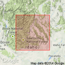
Named for Kinnikinic Creek, T11N, Rs17 and 18E (its type locality), which enters Salmon River at Clayton, Bayhorse quad, Custer Co, ID in the Idaho Mountains province. Name applied only to strata form Kinnikinic Creek northeast to Round Valley near Challis and the area on both sides of that valley. Consists of well-bedded, nearly pure white quartzite in which shaly partings and subordinate amounts of shaly calcareous beds are common. Many exposures stained brick-red through weathering of flakes of specularite which is sparsely disseminated through Kinnikinic. Irregularly lenticular aggregates of impure magnesian limestone and argillaceous beds present at several localities. Conglomerate [not described] present near Little Bayhorse Creek. Averages 3,000 ft thick. Partial section (1915 ft) measured at Wilbert mine, Butte Co in the Snake River basin. Fucoid markings and small calcareous algae. Assigned to Middle Ordovician on basis of stratigraphic position above Lower Ordovician Ramshorn slate (new) and below Upper Ordovician Saturday Mountain Formation (new). Correlation chart.
Source: GNU records (USGS DDS-6; Denver GNULEX).
- Usage in publication:
-
- Kinnikinic quartzite
- Modifications:
-
- Areal extent
- AAPG geologic province:
-
- Montana folded belt
Summary:
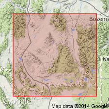
Occurs along crest of Beaverhead Range, near head of Nicholia Creek, Beaverhead Co, MT, Montana folded belt province. Unit is a few tens of feet thick overlying Beltian quartzites. This is only known occurrence of unit in MT. Correlates with Swan Peak quartzite in southeast ID. Isopach map of Ordovician. Middle Ordovician age.
Source: GNU records (USGS DDS-6; Denver GNULEX).
- Usage in publication:
-
- Kinnikinic Quartzite*
- Modifications:
-
- Revised
- Reference
- AAPG geologic province:
-
- Idaho Mountains province
Summary:
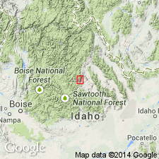
Restricted to one of six units, the uppermost quartzite, of Ross (1934). Overlies Ella Dolomite (adopted as defined by Patton in 1948) and underlies Middle Ordovician Saturday Mountain Formation. Other units formerly part of Kinnikinic now called Ella Dolomite, Clayton Mine Quartzite, Cash Creek Quartzite, carbonate unit, and lower quartzite unit. Quartzites along Kinnikinic Creek also excluded from formation. Name retained because of common usage. Reference section selected along Salmon River at south edges of secs 22, 23, and 24, T11N, R17E, Highway 93, 2 mi west of Clayton, Custer Co, ID in the Idaho Mountains province. Consists of light-gray to white, pure, well-sorted, medium- to thick-bedded, mostly medium grained quartzite about 700 ft thick. Has vitreous quartz grains cemented by secondary overgrowths of silica. Has some dark silica. Overlies Ella Dolomite; underlies Saturday Mountain Formation. Assigned a Middle Ordovician age because of its stratigraphic position beneath the Saturday Mountain, which has graptolites of middle Caradoc, Trenton, or late Middle Ordovician age.
Source: GNU records (USGS DDS-6; Denver GNULEX).
- Usage in publication:
-
- Kinnikinic Quartzite
- Modifications:
-
- Reference
- Dominant lithology:
-
- Quartzite
- AAPG geologic province:
-
- Snake River basin
Summary:
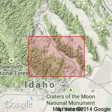
Reference section designated and measured in Arco Hills, 3.5 mi east-northeast of Arco, SW1/4 SW1/4 sec 27, T4N, R27E, Butte Co, ID, Snake River basin. Consists at the reference section of very fine to medium grained quartz arenite 325 m thick that lies above the Summerhouse? Formation and beneath the Lost River Member of the Fish Haven Formation. The quartz arenite is in parallel beds 0.1 to 1.6 ft thick. In the "type area" near Clayton, ID, the Kinnikinic is folded and faulted, is "darker," finer grained than elsewhere, and is divisible into a lower quartzite member at least 75 m thick, a middle shaly and quartzite member about 25 ft thick, and an upper quartzite member about 75 m thick. The shaly member has bryozoan, crinoid-like, brachiopod, and ?rhynchonellid fossils. This same fossil assemblage is found in the lower shaly unit of the overlying Saturday Mountain Formation in the Kinnikinic type area. The fossils probably show a transition from shelf deposits to east to slope deposits to south. Formation deposited in a shallow open-marine shelf in Middle Ordovician time. Geologic map.
Source: GNU records (USGS DDS-6; Denver GNULEX).
- Usage in publication:
-
- Kinnikinic Quartzite*
- Modifications:
-
- Overview
- AAPG geologic province:
-
- Idaho Mountains province
- Snake River basin
Summary:
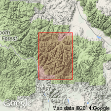
Mapped in southern and western margin of Pioneer window and a small outcrop occurs on map edge in northeastern part of Pioneer window within Blaine and Custer Cos, ID, Snake River basin and Idaho Mountains province. Consists of white, pink, yellow-brown, or mottled-gray vitreous, very pure (99% quartz) quartzite. Locally faintly laminated, and rarely contains thin muscovite partings. Upper 3 m is cross-bedded and coarser-grained. Thickness is 90-150 m. Base is abruptly gradational over Ella Marble (redescribed); conformably underlies Saturday Mountain Formation with sharp contact. Assigned Middle Ordovician age.
Source: GNU records (USGS DDS-6; Denver GNULEX).
For more information, please contact Nancy Stamm, Geologic Names Committee Secretary.
Asterisk (*) indicates published by U.S. Geological Survey authors.
"No current usage" (†) implies that a name has been abandoned or has fallen into disuse. Former usage and, if known, replacement name given in parentheses ( ).
Slash (/) indicates name conflicts with nomenclatural guidelines (CSN, 1933; ACSN, 1961, 1970; NACSN, 1983, 2005, 2021). May be explained within brackets ([ ]).

