The National Geologic Map Database is migrating to a new infrastructure. We apologize for any service disruptions during this process.
|
|---|


- Usage in publication:
-
- Kinney Rim Member*
- Modifications:
-
- Original reference
- Dominant lithology:
-
- Mudstone
- Sandstone
- AAPG geologic province:
-
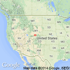
- Green River basin
Summary:
Pg. 4 (fig. 1), 12-14, 36-39, pls. Kinney Rim Member of Washakie Formation. Mostly gray, green, and some red mudstone and interbedded gray and gray-green, very fine to fine-grained sandstone. Thickness nearly 900 feet. Overlies Laney Shale Member of Green River Formation; contact is arbitrarily placed at base of limy tuff informally called white ridge marker bed (bed 515). Unconformably underlies Adobe Town Member of Washakie Formation. Fossils (vertebrates). Age is middle Eocene; Bridgerian Provincial Age of Wood and others (1941).
Type section: in SW/4 sec. 15 and S/2 sec. 16, T. 14 N., R. 99 W., [Chicken Creek East 7.5-min quadrangle], Sweetwater Co., southern WY. Named from exposures along lower east slopes of Kinney Rim, western part of Washikie basin, Sweetwater Co., southern WY.
Source: Publication; US geologic names lexicon (USGS Bull. 1520, p. 167).
For more information, please contact Nancy Stamm, Geologic Names Committee Secretary.
Asterisk (*) indicates published by U.S. Geological Survey authors.
"No current usage" (†) implies that a name has been abandoned or has fallen into disuse. Former usage and, if known, replacement name given in parentheses ( ).
Slash (/) indicates name conflicts with nomenclatural guidelines (CSN, 1933; ACSN, 1961, 1970; NACSN, 1983, 2005, 2021). May be explained within brackets ([ ]).