- Usage in publication:
-
- Kingshill series
- Modifications:
-
- Named
- Dominant lithology:
-
- Limestone
- Chalk
- Marl
- AAPG geologic province:
-
- Caribbean region
Summary:
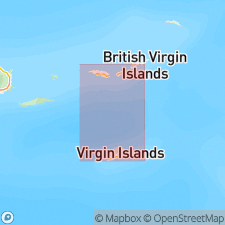
Probably named for Kings Hill [Kingshill] in western St. Croix, VI. Consists of white or cream-colored, soft limestones, chalky beds, and marls. Thickness may be 500 to 600 ft. Rests on upturned edges of older Mount Eagle series.
Source: GNU records (USGS DDS-6; Reston GNULEX).
- Usage in publication:
-
- Kingshill marl*
- Modifications:
-
- Revised
- Age modified
- AAPG geologic province:
-
- Caribbean region
Summary:
Revised as Kingshill marl. Overlies Jealousy formation (new) in test wells. Age is Oligocene to early Miocene.
Source: GNU records (USGS DDS-6; Reston GNULEX).
- Usage in publication:
-
- Kingshill marl*
- Modifications:
-
- Overview
- AAPG geologic province:
-
- Caribbean region
Summary:
Consists of buff to white, moderately thick-bedded limestone, alternating with soft cream or white marl. Limestone is hard, structureless, brittle, and cliff-forming; marl is softer. Well exposed along southern coast of island and in many small quarries where limestone is used for building stone. Exposed thickness just west of Christiansted, St. Croix, U.S. Virgin Islands, along scarp extending form Beeston Hill to Dolby Hill may be more than 600 ft. At Fair Plain, forms hills that attain 200 ft elev. above sea level and subsurface thickness of 180 ft, making total thickness nearly 400 ft. Calcareous conglomerate underlying Kingshill marl is exposed in stream beds near Jealousy and is believed to be basal conglomerate of Jealousy formation. Oligocene-Miocene contact is within Kingshill marl and is at least 108 ft above base in test well at Fair Plain.
Source: GNU records (USGS DDS-6; Reston GNULEX).

- Usage in publication:
-
- Kingshill Marl
- Modifications:
-
- Age modified
- AAPG geologic province:
-
- Caribbean region
Summary:
Plate 1 (geologic map) shows Kingshill Marl as early Miocene. Text states that youngest fossils in Kingshill Marl are early Miocene; author cites Cedarstrom (1950) [this reference states that Kingshill is Oligocene and Miocene, so Whetten's justification for an early Miocene age is unclear in his report].
Source: GNU records (USGS DDS-6; Reston GNULEX).
- Usage in publication:
-
- Kingshill Limestone
- Modifications:
-
- Revised
- Age modified
- AAPG geologic province:
-
- Caribbean region
Summary:
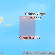
Revised name as Kingshill Limestone. Divides Kingshill into the following informal units (ascending): molluscan packstone facies (with lithic foraminiferal packstone subfacies), lithic foraminiferal grainstone facies, polymict packstone facies (with quartz arenite, coral lithic packstone, and foraminiferal packstone subfacies), foraminiferal wackestone facies, and foraminiferal grainstone facies. Exposures of polymict packstone facies at Villa La Reine shopping center are designated as type section. Over 70 ft (23 m) of section is exposed at Villa La Reine, including roadcut exposure on hill east of intersection of Northshore Rd and Centerline Rd. This location was chosen because it is best typical exposure, is easily accessible, and is closer to Kingshill (less than 1 mi) than exposures at Annas Hope which were deemed significant by Kemp (1926). Reference localities are given in report. Restriction of use of name to lowest major limestone rock unit on island is suggested. Age is early middle Miocene based on planktonic and benthic forams, corals, and cocoliths (Multer and others, 1977).
Source: GNU records (USGS DDS-6; Reston GNULEX).
- Usage in publication:
-
- Kingshill Limestone*
- Modifications:
-
- Age modified
- Biostratigraphic dating
- AAPG geologic province:
-
- Caribbean region
Summary:
Deposition of Kingshill Limestone began in late Oligocene and was contemporaneous with deposition of Jealousy Formation. Age of Kingshill is late Oligocene to late Miocene, and is mostly Miocene.
Source: GNU records (USGS DDS-6; Reston GNULEX).
- Usage in publication:
-
- Kingshill Marl*
- Modifications:
-
- Overview
- Age modified
- AAPG geologic province:
-
- Caribbean region
Summary:
Author follows usage of Whetten (1966) for the geologic units on St. Croix, VI. They include (ascending) the Late Cretaceous Mount Eagle Group, which consists of the Caledonia Formation, Allandale Formation, Cane Valley Formation (and its East End Member), and Judith Fancy Formation; Late Cretaceous Southgate Diorite and Fountain Gabbro intrusions; and Tertiary Jealousy Formation (early Eocene to middle Miocene) and Kingshill Marl (late Miocene, based on Gill, 1990).
Source: GNU records (USGS DDS-6; Reston GNULEX).
For more information, please contact Nancy Stamm, Geologic Names Committee Secretary.
Asterisk (*) indicates published by U.S. Geological Survey authors.
"No current usage" (†) implies that a name has been abandoned or has fallen into disuse. Former usage and, if known, replacement name given in parentheses ( ).
Slash (/) indicates name conflicts with nomenclatural guidelines (CSN, 1933; ACSN, 1961, 1970; NACSN, 1983, 2005, 2021). May be explained within brackets ([ ]).

