

- Usage in publication:
-
- Kingsdown marls
- Modifications:
-
- Original reference
- Dominant lithology:
-
- Marl
- AAPG geologic province:
-
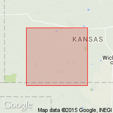
- Anadarko basin
Summary:
Pg. 53, 54. Kingsdown marls. Yellowish brown lacustrine or slack-water marls, with concentrations of carbonate and silicate of lime; 100 to 200 feet thick. Overlies Pearlette ash and unconformably underlies Quaternary. Supposed to be of late Pliocene age and to belong to Tule division of Cummins (EQUUS beds of Cope). [Age is Pleistocene.]
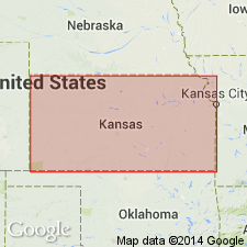
Named from Kingsdown, Ford Co., southwestern KS.
Source: US geologic names lexicon (USGS Bull. 896, p. 1099).
- Usage in publication:
-
- Kingsdown formation*
- Modifications:
-
- Revised
- AAPG geologic province:
-
- Anadarko basin
Smith, H.T.U., 1940, Geological studies in southwest Kansas: Kansas Geological Survey Bulletin, no. 34, 240 p.
Summary:
Pg. 111-116. Cragin's loosely defined Kingsdown marl of supposed late Pliocene age, redefined as Kingsdown formation to include beds of Pleistocene age only. It was included in Tertiary marl as mapped by Hay (1890, USGS Bull. 57). Formation consists of light-colored sand and gravel grading upward into characteristically light-buff even-bedded silt and clay containing some small and scattered calcareous concretions. Thickness 64 feet at section measured in Clark County, southwestern Kansas. Here the Kingsdown overlies Rexroad formation (new). Overlain by loess and seems locally to grade upward into loess from which it differs little except in its bedding.
Source: US geologic names lexicon (USGS Bull. 1200, p. 2018-2019).
- Usage in publication:
-
- Kingsdown silt
- Modifications:
-
- Revised
- AAPG geologic province:
-
- Anadarko basin
Summary:
Pg. 410-411. Kingsdown silt. Redefined to include overlying loess. Overlies Meade formation. [Age is Pleistocene.]
Source: US geologic names lexicon (USGS Bull. 1200, p. 2018-2019).
- Usage in publication:
-
- Kingsdown marl
- Modifications:
-
- Revised
- AAPG geologic province:
-
- Anadarko basin
Summary:
Pg. 745-752. Kingsdown marl apparently referred to by Cragin is divisible into an upper and lower part separated by a disconformity. Lower Kingsdown consists of light-buff silt and some sand and caliche pebbles, unconformable upon Meade formation and unconformably overlain by upper Kingsdown silt. Where well exposed in SE/4 sec. 17, T. 30 S., R. 23 W., Clark County, southwestern Kansas, the lower Kingsdown is 25 feet thick. Here the Kingsdown is channelled into the Meade formation. Upper Kingsdown silt consists of light-tan silt and fine sand, thin-bedded at base grading upward into massive silt and loess. Well exposed in NE/4 sec. 13, T. 30 S., R. 23 W., Clark County (section measured by Smith, 1940). [Age is Pleistocene.]
Source: US geologic names lexicon (USGS Bull. 1200, p. 2018-2019).
- Usage in publication:
-
- Kingsdown formation
- Modifications:
-
- Principal ference
- Revised
- AAPG geologic province:
-
- Anadarko basin
Summary:
Pg. 80-84. Kingsdown formation. Redefined to include sands and gravels at base of silt not recognized by Cragin but included by Hibbard (1944) in lower Kingsdown silt. Term formation used here instead of marls because unit here defined as formation consists both of channel sands and gravels and flood-plain silts containing large amounts of calcium carbonate. Use of formation as here restricted and redefined, is not use of term as defined by Smith (1940). Typical section given by Smith is of beds younger than those described by Cragin as Kingsdown marls and belongs to later cycle of erosion and deposition named and defined in this paper as Vanhem formation. In some areas, overlies Meade formation; in others, Crooked Creek formation (new). Age is Pleistocene. Type locality designated.
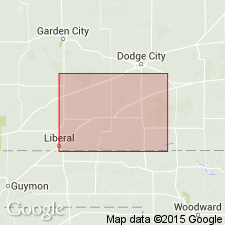
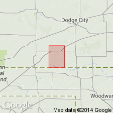
Type locality: along north side of upper part of Bluff Creek, Clark Co., southwestern KS; beds are well exposed in secs. 8, 17, 10, 11, 12, and 13, T. 30 S., R. 23 W., [Simmons Creek 7.5-min quadrangle, Clark Co., southwestern KS].
Type section: exposures north of George Taylor ranch house in walls of north-south gulch produced by tributary of Bluff Creek, in secs 8 and 17, T. 30 S., R. 23 W., [Simmons Creek 7.5-min quadrangle, Clark Co., southwestern KS].
Source: Publication; US geologic names lexicon (USGS Bull. 1200, p. 2018-2019).

- Usage in publication:
-
- Kingsdown marl
- Kingsdown formation*
- Modifications:
-
- Overview
Summary:
Pg. 110. Kingsdown marl or Kingsdown formation [=Loveland loess]. Listed among units that consist in part or entirely of deposits known to be of Illinoian or younger age, and which are properly classed at least in part as Sanborn formation.
Source: Publication; US geologic names lexicon (USGS Bull. 1200, p. 2018-2019).
- Usage in publication:
-
- Kingsdown formation
- Modifications:
-
- Revised
- AAPG geologic province:
-
- Anadarko basin
Summary:
Pg. 55 (fig. 1). Kingsdown formation. Lower formation in Sanborn group. Separated from underlying Crooked Creek formation of Meade group and overlying Vanhem formation of Sanborn group by unconformities. [Age is Pleistocene.]
Source: Publication; US geologic names lexicon (USGS Bull. 1200, p. 2018-2019).
- Usage in publication:
-
- Kingsdown*
- Modifications:
-
- Biostratigraphic dating
- AAPG geologic province:
-
- Anadarko basin
Hibbard, C.W., and Taylor, D.W., 1960, Two late Pleistocene faunas from southwestern Kansas: University of Michigan, Museum of Paleontology Contributions, v. 16, no. 1, p. 1-223.
Summary:
Pg. 7 (fig. 1), fig. 2 (facing p. 20), p. 25+, 39+, 55-58. Kingsdown formation of Sanborn group. Two late Pleistocene local faunas, the Butler Spring (Illinoian glacial age), dominated by cool climate species, and Cragin Quarry (Sangamon interglacial age), dominated by warmer semiarid climate species, are described in detail. Both occur in the alluvial facies of the Kingsdown, below the massive caliche bed, in Meade County, southwestern Kansas. [The Jinglebob local fauna (Sangamon? interglacial age; described in detail by Hibbard, 1955, Univ. Michigan Mus. Paleo. Contrib., v. 12, no. 10), occurs in beds above the caliche, in upper part of formation, Meade County, southwestern Kansas.] The sinkhole facies of the Kingsdown (Illinoian glacial age) includes (descending) Doby Springs and Berends local faunas in Harper and Beaver Counties (respectively), northwestern Oklahoma.
Source: Publication.
- Usage in publication:
-
- Kingsdown Formation*
- Modifications:
-
- Age modified
- Biostratigraphic dating
- Areal extent
- AAPG geologic province:
-
- Anadarko basin
- Nemaha anticline
Zakrzewski, R.J., 1975, Pleistocene stratigraphy and paleontology in western Kansas; The state of the art, 1974: University of Michigan, Museum of Paleontology Papers on Paleontology, no. 12., Claude W. Hibbard Memorial Volume, no. 3
Summary:
Kingsdown Formation. In southwestern Kansas [Meade County], includes (descending) Sangamon interglacial age Cragin Quarry local fauna, and Illinoian glacial age Mt. Scott, Butler Spring, and Adams local faunas. Lies above Pearlette Type O ash bed [Lava Creek B ash bed] and Cudahy local fauna (early Pleistocene; Irvingtonian NALMA; Kansan and Yarmouth) and below Vanhem Formation (Pleistocene; Rancholabrean NALMA; Wisconsinan). In northeastern Kansas, Smoky Hill and Saline River area [Geary County], includes (descending) Illinoian glacial age Duck Creek, Williams, and Sandahl local faunas. Age is Pleistocene (Rancholabrean NALMA); Pliocene-Pleistocene boundary placed at base of Irvingtonian NALMA (base of Nebraskan-Aftonian), = 1.8 Ma.
Source: Publication.
- Usage in publication:
-
- Kingsdown Formation
- Modifications:
-
- Not used
- AAPG geologic province:
-
- Anadarko basin
Summary:
Kingsdown Formation. Strata included in unnamed Pleistocene deposits. [Pliocene-Pleistocene boundary placed at 1.8 Ma.]
Source: Publication.
- Usage in publication:
-
- Kingsdown Formation*
- Modifications:
-
- Not used
- AAPG geologic province:
-
- Anadarko basin
Martin, R.A., Honey, J.G., and Pelaez-Camponanes, Pablo, 2000, The Meade basin [Kansas] rodent project; a progress report: Paludicola, v. 3, no. 1, p. 1-32.
Summary:
Deposits of the Kingsdown Formation of Hibbard and Taylor (1960) and Zakrzewski (1975) are included in unnamed Pleistocene deposits overlying Crooked Creek and older formations; they contain Rancholabrean NALMA (Illinoian and Sangamon age) Cragin Quarry, Mt. Scott, Butler Spring, and Adams local faunas.
Source: Publication.
For more information, please contact Nancy Stamm, Geologic Names Committee Secretary.
Asterisk (*) indicates published by U.S. Geological Survey authors.
"No current usage" (†) implies that a name has been abandoned or has fallen into disuse. Former usage and, if known, replacement name given in parentheses ( ).
Slash (/) indicates name conflicts with nomenclatural guidelines (CSN, 1933; ACSN, 1961, 1970; NACSN, 1983, 2005, 2021). May be explained within brackets ([ ]).