

- Usage in publication:
-
- King Peak rhyolite*
- Modifications:
-
- Named
- Dominant lithology:
-
- Rhyolite
- AAPG geologic province:
-
- Southwestern Basin-and-Range region
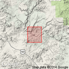
Summary:
Named for King Peak, southwest part of map. Extends northwest of King Peak and about 1 mi north-northeast toward Copper Creek and along Bridle Creek, southwest part of Bagdad area, Yavapai Co, AZ in Southwestern Basin-and-Range region. No type locality designated. Is a fine-grained non-porphyritic intrusive rhyolite containing quartz and feldspar. Generally massive, white and sugary on unweathered surfaces, and brown to tan locally. Has inclusions of volcanics from Bridle formation. Alternating layers, averaging 20 ft in width parallel bedding structure of Bridle, suggesting bed-by-bed intrusion of the rhyolite. Main mass near Copper King mine probably intruded along a fault. Outcrop pattern suggests intrusion after deposition of the older Yavapai series. Of pre-Cambrian age. Geologic map.
Source: GNU records (USGS DDS-6; Denver GNULEX).
For more information, please contact Nancy Stamm, Geologic Names Committee Secretary.
Asterisk (*) indicates published by U.S. Geological Survey authors.
"No current usage" (†) implies that a name has been abandoned or has fallen into disuse. Former usage and, if known, replacement name given in parentheses ( ).
Slash (/) indicates name conflicts with nomenclatural guidelines (CSN, 1933; ACSN, 1961, 1970; NACSN, 1983, 2005, 2021). May be explained within brackets ([ ]).