- Usage in publication:
-
- King Ferry shale member
- Modifications:
-
- Named
- Dominant lithology:
-
- Shale
- AAPG geologic province:
-
- Appalachian basin
Summary:
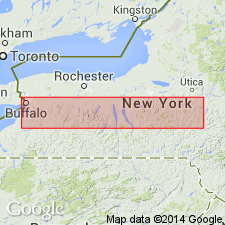
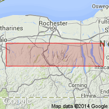
Name King Ferry shale member of Ludlowville formation introduced in this report. Unit is mostly dark arenaceous shale, and occupies interval between Ledyard shale below and Portland Point limestone member of Moscow formation above. Equivalent to Wanakah and Deep Run members, which could not be differentiated between Seneca and Owasco Lakes. Uppermost member of Ludlowville in Cayuga Lake region. Thickness 120 to 130 ft. Age is Middle Devonian.
Source: GNU records (USGS DDS-6; Reston GNULEX).

- Usage in publication:
-
- King Ferry Member
- Modifications:
-
- Revised
- AAPG geologic province:
-
- Appalachian basin
Summary:
Equivalent to Wanakah and Jaycox Shale Members. Includes two diastems, 3 to 12 m apart in the lower middle part: Bloomer Creek Bed (upper) and Barnum Creek Bed. Both vary between 18 and 45 cm in thickness in the Cayuga Valley and are marked by shell concretions, hiatus concretions, and pre-fossilized debris. Both formed partly through wave- and current-induced submarine erosion. A 13 to 19 cm siltstone layer between the diastems is termed the Mack Creek Bed.
Source: GNU records (USGS DDS-6; Reston GNULEX).

- Usage in publication:
-
- King Ferry
- Modifications:
-
- Not used
- AAPG geologic province:
-
- Appalachian basin
Summary:
King Ferry Member of Ludlowville Formation not used in this report. Spafford and Jaycox Members have been extended into the Owasco Lake-Skaneateles Lake region southwest of Syracuse, replacing the King Ferry, at least in part, and eliminating the need for the local name.
Source: GNU records (USGS DDS-6; Reston GNULEX).
For more information, please contact Nancy Stamm, Geologic Names Committee Secretary.
Asterisk (*) indicates published by U.S. Geological Survey authors.
"No current usage" (†) implies that a name has been abandoned or has fallen into disuse. Former usage and, if known, replacement name given in parentheses ( ).
Slash (/) indicates name conflicts with nomenclatural guidelines (CSN, 1933; ACSN, 1961, 1970; NACSN, 1983, 2005, 2021). May be explained within brackets ([ ]).

