

- Usage in publication:
-
- Kimball formation
- Modifications:
-
- Original reference
- Dominant lithology:
-
- Silt
- Clay
- Sand
- AAPG geologic province:
-
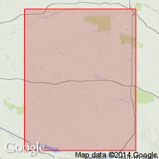
- Denver basin
Summary:
Pg. 224, 227; 1939, GSA Bull., v. 50, no. 8, p. 1262-1264, 1266 (table 2). Kimball formation of Ogallala formation. Uppermost formation in group. Consists of silt, clay, and fine sand more or less cemented with caliche, with 1 or 2 algal limestone beds at top; pinkish to reddish. Thickness 25 to 50 feet. Overlies Sidney gravel (new). [Age is] very late Pliocene.
Typical exposure: at the High Plains level, about 2 mi south of Kimball, in vicinity of adjoining corners of secs. 5, 6, 7, and 8, T. 14 N., R. 55 W., Kimball Co., southwestern NE.
Source: Publication; US geologic names lexicon (USGS Bull. 1200, p. 2010-2011).
- Usage in publication:
-
- Kimball formation
- Modifications:
-
- Revised
Schultz, C.B., and Stout, T.M., 1948, Pleistocene of the Great Plains: Geological Society of America Bulletin, v. 59, no. 6, p. 541-588.
Summary:
Pg. 553-588. Kimball formation of Ogallala group. Includes Sidney gravel and silt member. Discussion of Pleistocene mammals and terraces in Great Plains. Unconformity between Kimball and Broadwater formations is most significant stratigraphic break in upper Tertiary and Pleistocene deposits of western Nebraska and Great Plains in general. Faunal break between Kimball and Broadwater is most important one paleontologically in same area. This break believed to be Pliocene-Pleistocene boundary.
Source: US geologic names lexicon (USGS Bull. 2010-2011).

- Usage in publication:
-
- Kimball member*
- Modifications:
-
- Revised
Summary:
Pg. 20. Kimball member of Ogallala formation. Is member of Ogallala formation in Kansas. [Age is late Pliocene.]
Source: US geologic names lexicon (USGS Bull. 2010-2011).
- Usage in publication:
-
- Kimball member
- Modifications:
-
- Overview
- AAPG geologic province:
-
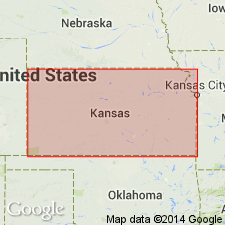
- Anadarko basin
- Central Kansas uplift
- Chadron arch
- Las Animas arch
- Salina basin
Summary:
Pg. 60-64, 67+ (measured sections), pl. Kimball member of Ogallala formation. Is uppermost member of Ogallala formation. Consists mostly feldspathic medium to fine sands and silts; in places contains up to 12 feet of opaline chert, lentils of Sidney gravel in basal part, and impure relatively soft limestone in upper half to third of member. Uppermost beds, the "algal limestone," exposed on Cretaceous highlands of Russell, Lincoln, Osborne, Mitchell, Jewell, and Cloud Counties, give this member the most widespread geographic distribution. Average thickness about 30 feet. Fossils. Plants PROLITHOSPERMUM JOHNSONI, BERRICHLOA MINUTA, and B. MAXIMA; mollusks PROMENETUS BLANCOENSIS and LYMNAEA MACELLA. Age is
Exposures limited; occurs as isolated remnants.
Source: Publication.
- Usage in publication:
-
- Kimball Formation†
- Modifications:
-
- Abandoned
- AAPG geologic province:
-
- Denver basin
Diffendal, R.F., Jr., 1990, The Sidney Gravel and Kimball Formation; supposed parts of the Ogallala Group (Neogene), are not objectively mappable units: University of Texas-Austin, Bureau of Economic Geology, p. 23-38., Reprinted as University of Nebraska-Lincoln, Conservation and Survey Division, Papers in Natural Resources, no. 137
Summary:
†Kimball Formation of Ogallala Group. Abandoned. It is not widespread, sheetlike, or mappable. No widespread marker bed occurs in the unit to separate it from the Ash Hollow Formation of the Ogallala Group. Lithology supposedly diagnostic of the Kimball recur throughout the Ogallala in southern Panhandle of Nebraska. The Kimball can not be uniquely defined and traced from its type area. Usage of the Kimball as a rock unit in Nebraska and adjacent states should be abandoned by all workers. The term Ash Hollow Formation should be used in its place.
[See also Swinehart and others (1985) entry under Ash Hollow Formation.]
Source: Publication.

- Usage in publication:
-
- Kimball Member
- Modifications:
-
- Not used
- AAPG geologic province:
-
- Denver basin
Summary:
Kimball Member of Ogallala Formation. Discarded by the Kansas Geol. Survey. Validity of name in question because of depositional nature of the Ogallala and distance from type section. Rocks included in Ogallala Formation, undivided. [Sidney Gravel Bed included in Ogallala Formation, undivided.]
Source: Publication.
For more information, please contact Nancy Stamm, Geologic Names Committee Secretary.
Asterisk (*) indicates published by U.S. Geological Survey authors.
"No current usage" (†) implies that a name has been abandoned or has fallen into disuse. Former usage and, if known, replacement name given in parentheses ( ).
Slash (/) indicates name conflicts with nomenclatural guidelines (CSN, 1933; ACSN, 1961, 1970; NACSN, 1983, 2005, 2021). May be explained within brackets ([ ]).