

- Usage in publication:
-
- Kilbourn Formation
- Modifications:
-
- Named
- Dominant lithology:
-
- Sandstone
- Siltstone
- Shale
- Limestone
- AAPG geologic province:
-
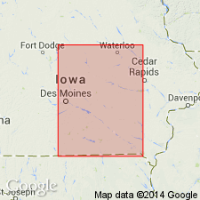
- Iowa shelf
Summary:
Named as the basal formation (1 of 4) of the Cherokee Group of Des Moines Supergroup for the town of Kilbourn, north-central Van Buren Co, IA on the Iowa shelf. Type locality is an abandoned quarry in NW1/4, SE1/4 sec 36, T70N, R10W in Van Buren Co. Overlies unnamed Mississippian limestone. A thin (6 to 8 inches) zone of iron-stained pebbles or concretions grading into green clay present at top of Mississippian may represent a soil or weathering surface. Underlies the newly named Blackoak Coal Member of the Kalo Formation (new) of Cherokee Group. Is lithologically variable. Dominantly nonmarine sandstone, shale, and siltstone and thin marine limestones. Has some thin discontinuous coals. The shale is gray, finely laminated, silty. Gypsum crystals abundant throughout shale. Is 23.5 ft thick at type. Maximum thickness of 218 ft present in Polk Co where formation has at least 4 cycles of sandstone, siltstone, shale, coal, and locally in Polk, Warren, and Clarke Cos some channel sandstones with intraformational conglomerates and erosional unconformities at base of each cycle. Has a maximum thickness of only 1 ft in southeast Davis Co where it is composed only of thin, rooted conglomeratic sandstone. Nomenclature chart. Cross section. Represents deposits that filled the erosional irregularities of the Mississippian surface. Kilbourn depo --probably resulted from subsidence of Forest City basin. Some local swamps; some evidence of marine inundation. Of Pennsylvanian, Atokan age. Present over a large area on the Iowa shelf.
Source: GNU records (USGS DDS-6; Denver GNULEX).
For more information, please contact Nancy Stamm, Geologic Names Committee Secretary.
Asterisk (*) indicates published by U.S. Geological Survey authors.
"No current usage" (†) implies that a name has been abandoned or has fallen into disuse. Former usage and, if known, replacement name given in parentheses ( ).
Slash (/) indicates name conflicts with nomenclatural guidelines (CSN, 1933; ACSN, 1961, 1970; NACSN, 1983, 2005, 2021). May be explained within brackets ([ ]).