The National Geologic Map Database is migrating to a new infrastructure. We apologize for any service disruptions during this process.
|
|---|


- Usage in publication:
-
- Keyser limestone
- Modifications:
-
- Original reference
- Dominant lithology:
-
- Limestone
- AAPG geologic province:
-
- Appalachian basin
Summary:
Pg. 563, 590, 591, pl. 28. Keyser limestone. Basal formation of Helderberg of New York, Pennsylvania, Maryland, Virginia, and West Virginia. Underlies Coeymans limestone and unconformably overlies upper Cayugan deposits (including (?) Manlius of New York). [Age is Early Devonian.]
[Named from exposures at Keyser, Keyser 7.5-min quadrangle, Mineral Co., northern WV.]
Source: US geologic names lexicon (USGS Bull. 896, p. 1090).
- Usage in publication:
-
- Keyser Limestone*
- Modifications:
-
- Revised
- Biostratigraphic dating
- AAPG geologic province:
-
- Appalachian basin
Summary:
The Byers Island, Jersey Shore, and La Vale Members of Head (1972) of the Keyser Limestone are here accepted for USGS use. Conodont data and extrapolation from regional lithofacies relationships indicate that the Silurian-Devonian boundary lies within the uppermost Keyser Limestone (in the upper limestone member in west-central VA and east-central WV, and in the La Vale Member in northeast WV and central PA) [and in MD by implication]. Therefore, Byers Island, Jersey Shore, Big Mountain Shale, and Clifton Forge Sandstone Members are considered Late Silurian.
Source: GNU records (USGS DDS-6; Reston GNULEX).
- Usage in publication:
-
- Keyser Formation
- Modifications:
-
- Overview
- AAPG geologic province:
-
- Appalachian basin
Summary:
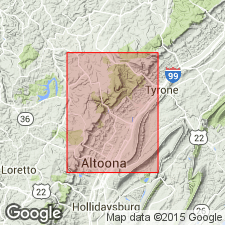
Keyser Formation is a series of fossiliferous beds consisting at its type locality of distinctive nodular limestone overlain by thick- and thin-bedded limestone and laminated limestone. Unit extends throughout the Valley and Ridge province from east-central PA to western VA. It is recognized by its "peculiar, lumpy character." The basal "calico" limestone in the study area is a fossiliferous, medium-light- to medium-gray very thick bedded calcilutite containing numerous small irregular patches of clear calcite. The abundantly fossiliferous, nodular limestone at the base in most of the Valley and Ridge, overlies the "calico" here. Overlying this is 5 to 6 m of fragmental calcarenite containing abundant crinoid columnals. Above the calcarenite is 6 m of fossiliferous, banded calcisiltite. The uppermost 15 m is a sequence alternating between laminated, stromatolitic calcisiltite, and calcilutite and calcisiltite that are argillaceous and fossiliferous. Contact with lower Tonoloway is probably conformable, but sharp enough to suggest an unconformity. Upper contact with the Old Port Formation is conformable. Thickness at the Allegheny Furnace section in Altoona is 33 m. Age is Late Silurian and Early Devonian.
Source: GNU records (USGS DDS-6; Reston GNULEX).

- Usage in publication:
-
- Keyser Limestone*
- Modifications:
-
- Biostratigraphic dating
- AAPG geologic province:
-
- Appalachian basin
Summary:
Conodont biostratigraphy indicates that the Keyser Limestone of the Helderberg Group in northern VA, northeastern WV, and western MD is of latest Silurian (Pridolian) and earliest Devonian (Lochkovian) age. The Silurian-Devonian boundary occurs near the top of the formation.
Source: GNU records (USGS DDS-6; Reston GNULEX).
For more information, please contact Nancy Stamm, Geologic Names Committee Secretary.
Asterisk (*) indicates published by U.S. Geological Survey authors.
"No current usage" (†) implies that a name has been abandoned or has fallen into disuse. Former usage and, if known, replacement name given in parentheses ( ).
Slash (/) indicates name conflicts with nomenclatural guidelines (CSN, 1933; ACSN, 1961, 1970; NACSN, 1983, 2005, 2021). May be explained within brackets ([ ]).