

- Usage in publication:
-
- Kevin shale member*
- Modifications:
-
- Named
- Dominant lithology:
-
- Shale
- Bentonite
- Limestone
- AAPG geologic province:
-
- Sweetgrass arch
Summary:
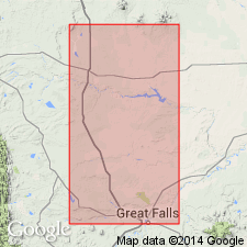
Named as the upper member of Marias River Shale (new) of Colorado group (rank raised) for town of Kevin on Shelby-Sweetgrass branch of the Great Northern Railway, Toole Co, MT on the Sweetgrass arch. Type section designated northwest of Kevin in secs 3, 4, 12, 13, 17, 18 and 24, T35N, Rs3 and 4W where the member is 620 ft thick, and where it overlies the Ferdig shale member and underlies Telegraph Creek Formation. Upper contact marked by a pronounced color change from dark gray in the Kevin to yellowish gray and buff of Telegraph Creek. Divided into 1) a dark gray shale that includes numerous beds of bentonite, calcareous concretions, concretionary limestone, and caramel-brown prismatic calcite cone-in-cone structure; 2) dark gray shale distinguished by layers of reddish-weathering concretions of ferruginous limestone and dolostone; 3) dark gray shale. Includes in middle part of member, the MacGowan concretionary bed (new). Includes the "First white specks" on north side of Kevin-Sunburst dome. Correlates with Niobrara formation. Is of Late Cretaceous, Coniacian and Santonian age. Correlation chart.
Source: GNU records (USGS DDS-6; Denver GNULEX).
- Usage in publication:
-
- Kevin Shale Member*
- Modifications:
-
- Overview
- AAPG geologic province:
-
- Montana folded belt
Summary:
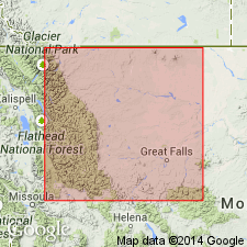
Is mapped as top member of Marias River Shale in eastern Lewis and Clark Co, MT in Montana folded belt province. Overlies sandstone member or Ferdig Shale Member of Marias River; underlies Telegraph Creek Formation. Is dark-gray to black fissile calcareous shale; thin interbeds of olive-gray siltstone in upper and lower part; contains many thin beds of light-gray, yellowish-gray, and yellowish-orange bentonite and numerous zones of septarian limestone and ferruginous limestone concretions; invertebrate fossils locally abundant; mainly SCAPHITES DEPRESSUS Reeside, SCAPHITES VENTRICOSUS Meek and Hayden, BACULITES ASPER Morton, and INOCERAMUS DEFORMIS Meek; about 300 ft thick. Age is Late Cretaceous. [Molluscan zonation of Obradovich and Cobban (1975) indicates age assignments as follow: S. DEPRESSUS -early Santonian; S. VENTRICOSUS -late Coniacian; I. DEFORMIS -early Coniacian.]
Source: GNU records (USGS DDS-6; Denver GNULEX).
- Usage in publication:
-
- Kevin Member*
- Modifications:
-
- Redescribed
- Overview
- Dominant lithology:
-
- Shale
- Sandstone
- Limestone
- Dolostone
- Bentonite
- AAPG geologic province:
-
- Sweetgrass arch
Summary:
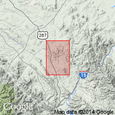
Is the upper member of Marias River Shale of Colorado Group. Term shale removed from name. Detailed description of type section measured in N1/2, T35N, R3W, Toole Co, MT, Sweetgrass arch. Has the greatest outcrop area of all members of Marias River. Extends in a narrow outcrop belt from Sun River north to the International boundary. Thickens west from type (188 m) to 213 m at Cut Bank oil field. Changes little in thickness to east. Is a gray (dark to olive) marine shale with thin sandstone and bentonite beds, and many concretion layers. Includes Mac Gowan Concretionary Bed. Shale ranges from calcareous to noncalcareous, and some beds are sandy. Sandstone is gray, fine grained, thinly laminated to cross bedded. Ledge-forming gray, sometimes concretionary, sometimes ferruginous, gray concretionary dolostone, and a few dark gray siltstone beds also present. Overlies Ferdig Member of Marias River. Underlies Telegraph Creek Formation. Equivalent to Niobrara of Great Plains. Of Late Cretaceous, Coniacian and Santonian age.
Source: GNU records (USGS DDS-6; Denver GNULEX).
For more information, please contact Nancy Stamm, Geologic Names Committee Secretary.
Asterisk (*) indicates published by U.S. Geological Survey authors.
"No current usage" (†) implies that a name has been abandoned or has fallen into disuse. Former usage and, if known, replacement name given in parentheses ( ).
Slash (/) indicates name conflicts with nomenclatural guidelines (CSN, 1933; ACSN, 1961, 1970; NACSN, 1983, 2005, 2021). May be explained within brackets ([ ]).