- Usage in publication:
-
- Ketcherside tuff
- Modifications:
-
- First used
- Dominant lithology:
-
- [Tuff]
- Pyroclastics
- AAPG geologic province:
-
- Midcontinent region
Summary:
Ketcherside tuff (new) of Van East group (new). Briefly summarized in reports by W.C. Hayes and J.A. Martin, p. 29, and W.C. Hayes, p. 81, 83 (table 1), this volume. New names are credited to Tolman and Robertson (in prep.) [1969, Missouri Div. Geol. Survey Water Res. Rpt. Inv., no. 44 (Contrib. to Precambrian Geol., no. 1)]. Volcanic ash beds. Near north end of outcrop a basal conglomerate of the Bonneterre rests on the Precambrian pyroclastics. A shear zone near center of exposure displaces the tuff. Age is Precambrian.
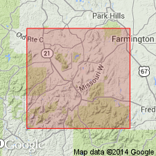
Outcrop shown in SE/4 SW/4 SE/4 sec. 11, T. 33 N., R. 3 E., Iron Co., southeastern MO. Ketcherside Mountain and Ketcherside Gap are in Iron Co.
Source: Modified from US geologic names lexicon (USGS Bull. 1350, p. 389-390).

- Usage in publication:
-
- Ketcherside tuff
- Modifications:
-
- Principal reference
- Dominant lithology:
-
- Tuff
- Pyroclastics
- Agglomerate
- Breccia
- AAPG geologic province:
-
- Midcontinent region
Summary:
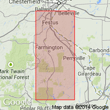
Ketcherside tuff. Unit serves as stratigraphic marker separating Middlebrook and Van East groups. Consists of bedded tuffs, lapilli tuffs, pyroclastic breccias, and agglomerates that were probably deposited in shallow water. All bedded tuffs in area are assigned to the Ketcherside. Exposed in St. Francois Mountains, Iron, Wayne, and Shannon Counties, southeastern Missouri. Best exposed on Pilot Knob where unit consists of two tuff beds mineralized with hematite, and are separated by a sheared unmineralized zone; thickness of lower bed is 6 to 30 feet and upper bed is 10 to 30 feet. Separated from underlying Middlebrook group by an erosional unconformity; erosion may have removed more than 1,000 feet of Middlebrook. Age is Precambrian.
Origin of name not stated by authors, but probably named from exposures on lower flanks of Ketcherside Mountain, in sec. 25, T. 33 N., R. 3 E., Iron Co., southeastern MO. (Type locality not designated.)
Source: Modified from GNU records (USGS DDS-6; Denver GNULEX).

- Usage in publication:
-
- Ketcherside Tuff
- Modifications:
-
- Not used
Summary:
Ketcherside Tuff. Not used in St. Francois Mountains, southeast Missouri (Midcontinent region). Nomenclature of Tolman and Robertson (1969) revised because of better understanding of regional structure and recognition of individual units consisting of ash-flow tuffs, air-fall tuffs, lava flows, and mixtures of these. Tolman and Robertson (1969) considered all bedded tuffs to be Ketcherside, which separated their Middlebrook Group (not used here) from their Van East Group (not used here). Author divides layered rocks in St. Francois Mountains into 14 formations; believes these were deposited during a single episode of volcanic activity associated with the Taum Sauk Caldera.
Source: Modified from GNU records (USGS DDS-6; Denver GNULEX).
For more information, please contact Nancy Stamm, Geologic Names Committee Secretary.
Asterisk (*) indicates published by U.S. Geological Survey authors.
"No current usage" (†) implies that a name has been abandoned or has fallen into disuse. Former usage and, if known, replacement name given in parentheses ( ).
Slash (/) indicates name conflicts with nomenclatural guidelines (CSN, 1933; ACSN, 1961, 1970; NACSN, 1983, 2005, 2021). May be explained within brackets ([ ]).

