

- Usage in publication:
-
- Kennett formation*
- Modifications:
-
- Named
- Dominant lithology:
-
- Shale
- Sandstone
- Limestone
- AAPG geologic province:
-
- Klamath Mountains province
Summary:
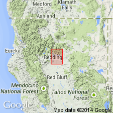
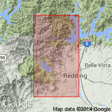
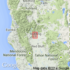
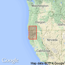
Kennett formation first described by J.P. Smith (1894 in Journal of Geology v.2, p.591-593) as Kennett limestone and shales in Sacramento formation. Consists chiefly of black shales, often cherty with some thin-bedded sandstones and lenticular bodies of gray, highly fossiliferous limestone. No complete section noted; however, one good section is on left slope of Backbone Creek, 3.5 mi north of Kennett in Redding quad. Occurs in isolated patches scattered sparsely over irregular area 20 mi long by 10 mi wide. Fossils collected in Kennett shales and limestone yield Middle Devonian age; unit assigned Middle Devonian age. Conformably overlies volcanic rocks of Copley meta-andesite and Balaklala rhyolite; unconformably overlain by Bragdon formation.
Source: GNU records (USGS DDS-6; Menlo GNULEX).
- Usage in publication:
-
- Kennett formation*
- Modifications:
-
- Overview
- AAPG geologic province:
-
- Klamath Mountains province
Summary:
Consists almost entirely of shale and limestone with minor beds of shaly tuff and crystal tuff interbedded with shale near base. Is exposed throughout northern part of west Shasta district --most extensively in southern part of Behemotosh Mountain quadrangle. Maximum thickness in west Shasta district is no more than 400 feet; other investigations have reported thicknesses in excess of 800 feet, but discrepancy is in part due to repetition of beds due to faulting. Is overlain conformably by Bragdon formation and is gradational with underlying Balaklala rhyolite. Black siliceous shales are thin-bedded and commonly contorted and cut by thin quartz veinlets. Other rocks below limestone are coarse- to fine-grained tuff, conglomerate, sandstone, siltstone, and porphyritic rhyolite. Limestone is thinly to thickly bedded, in part massive. Upper 50 feet is highly fossiliferous with abundant coral debris and some chert nodules and bands. Age is Middle Devonian.
Source: GNU records (USGS DDS-6; Menlo GNULEX).
- Usage in publication:
-
- Kennett Formation*
- Modifications:
-
- Age modified
- AAPG geologic province:
-
- Klamath Mountains province
Summary:
Age changed from Middle Devonian to Early or Middle Devonian based on stratigraphic position and fossils (radiolarians and probable Middle Devonian macrofossils).
Source: GNU records (USGS DDS-6; Menlo GNULEX).
- Usage in publication:
-
- Kennett Formation*
- Modifications:
-
- Age modified
- AAPG geologic province:
-
- Klamath Mountains province
Summary:
Age of unit reported as Early(?) and Middle Devonian based on macro fossils of late Eifelian age (Middle Devonian) and stratigraphic relations with underlying volcanic rocks.
Source: GNU records (USGS DDS-6; Menlo GNULEX).
For more information, please contact Nancy Stamm, Geologic Names Committee Secretary.
Asterisk (*) indicates published by U.S. Geological Survey authors.
"No current usage" (†) implies that a name has been abandoned or has fallen into disuse. Former usage and, if known, replacement name given in parentheses ( ).
Slash (/) indicates name conflicts with nomenclatural guidelines (CSN, 1933; ACSN, 1961, 1970; NACSN, 1983, 2005, 2021). May be explained within brackets ([ ]).