The National Geologic Map Database is migrating to a new infrastructure. We apologize for any service disruptions during this process.
|
|---|


- Usage in publication:
-
- Kenilworth member
- Modifications:
-
- Named
- Dominant lithology:
-
- Sandstone
- Shale
- Coal
- AAPG geologic province:
-
- Uinta basin
Summary:
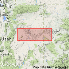
Named for exposures near Kenilworth, Carbon Co, UT in the Uinta basin as one of six members of Blackhawk Formation. No type locality designated. Consists of massive, cliff-forming, medium-grained, buff sandstone 85 ft thick at base, gray to black shale with lenses of white and buff sandstone, and four minable coals about 160 ft thick. Four coals called Kenilworth or Castlegate "D", a 19 ft thick coal, and in order oldest to youngest, the Gilson, Fish Creek, and Rock Canyon coals. Offshore bar sandstone formed the barrier behind which the black shale, sandstone, and coal were deposited. The two lower bar sandstones were deposited considerably inland from the seaward edge of the swamp. The eastwardmost extension of the lagoonal rocks is located almost to the Green River. The basal sandstone is gradational into Mancos shale. Overlain disconformably by Sunnyside member of Blackhawk. Some beds of the basal sandstone are cross-bedded. Cross sections. Late Cretaceous age.
Source: GNU records (USGS DDS-6; Denver GNULEX).
- Usage in publication:
-
- Kenilworth Member*
- Modifications:
-
- Principal reference
- Revised
- Dominant lithology:
-
- Sandstone
- Mudstone
- Claystone
- AAPG geologic province:
-
- Uinta basin
Summary:
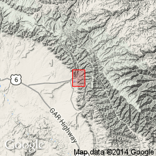
Assigned as a member (of 5 members) of Blackhawk Formation of Mesaverde Group. Type locality stated to be an exposure near town of Kenilworth, UT. Principal reference section designated and measured (this report) on north side of mouth of Fan and Water Canyons in NW1/4 sec 8, T15S, R14E, Carbon Co, UT in the Uinta basin where member: 1) overlies Mancos Shale; 2) is 220 ft thick; 3) divided into lower, middle, and upper sandstone tongues; and 4) underlies lower mudstone member of Blackhawk. Placement of lower in this report is a modification of the contact used by Young in 1955 in that: 1) two sandstones and siltstones beneath Young's Kenilworth are included in Kenilworth; and 2) a thin coal and siltstone at top are removed from Kenilworth and called lower mudstone member of Blackhawk. At reference section consists of orange, pink, to gray, very fine to fine grained, calcareous, carbonaceous to noncarbonaceous sandstone that is interbedded with gray, carbonaceous silty to sandy mudstone and red-brown claystone lenses. Sandstone is the predominant lithology (186 ft) at the principal reference section. Cross section; nomenclature chart; geologic map. Trace fossils abundant in the sandstone. Of Late Cretaceous age.
Source: GNU records (USGS DDS-6; Denver GNULEX).
For more information, please contact Nancy Stamm, Geologic Names Committee Secretary.
Asterisk (*) indicates published by U.S. Geological Survey authors.
"No current usage" (†) implies that a name has been abandoned or has fallen into disuse. Former usage and, if known, replacement name given in parentheses ( ).
Slash (/) indicates name conflicts with nomenclatural guidelines (CSN, 1933; ACSN, 1961, 1970; NACSN, 1983, 2005, 2021). May be explained within brackets ([ ]).