

- Usage in publication:
-
- Kendall sandstone member
- Modifications:
-
- Named
- Dominant lithology:
-
- Sandstone
- AAPG geologic province:
-
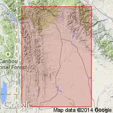
- Green River basin
Summary:
Pg. 129-130. Kendall sandstone member of Gypsum Spring formation. Name proposed for the basal member of the Gypsum Spring. Previously considered to be the upper member of the Nugget formation and termed "Nugget Pay." Described as marine type clastics including sandstone, siltstone, and some thin limestones [sequence of lithologies not discussed]. Sandstone is buff, tan, and red, soft, poorly consolidated, easily eroded. Thickness in outcrop about 20 to 25 feet. In subsurface, thickness is 28 feet in the Costello No. 1 Government well, sec. 7, T. 37 N., R. 109 W. (contacts placed at 3,250 feet and 3, 278 feet); is 21 feet thick in the Ellswork 1-5 Government well, sec. 5, T. 37 N., R. 109 W. (contacts placed at 2,525 feet and 2,546 feet). Limestone not present in either well. Overlies cross-bedded sandstone of the Nugget. Underlies upper part of Gypsum Spring formation [not discussed]. Present in western Wyoming. Age is Jurassic.
Type locality (or "Type well") not designated. Well exposed in southwest part of sec. 25, T. 38 N., R. 110 W., Sublette Co., WY [Greater Green River basin]. Named from nearby Kendall Ranger Station and local name for valley in which station is located and sandstone exposed.
Source: US geologic names lexicon (USGS Bull. 1200, p. 1989); supplemental information from GNU records (USGS DDS-6; Denver GNULEX).
For more information, please contact Nancy Stamm, Geologic Names Committee Secretary.
Asterisk (*) indicates published by U.S. Geological Survey authors.
"No current usage" (†) implies that a name has been abandoned or has fallen into disuse. Former usage and, if known, replacement name given in parentheses ( ).
Slash (/) indicates name conflicts with nomenclatural guidelines (CSN, 1933; ACSN, 1961, 1970; NACSN, 1983, 2005, 2021). May be explained within brackets ([ ]).