- Usage in publication:
-
- Kellerville Till Member
- Modifications:
-
- Named
- Dominant lithology:
-
- Till
- AAPG geologic province:
-
- Illinois basin
- Wisconsin arch
Summary:
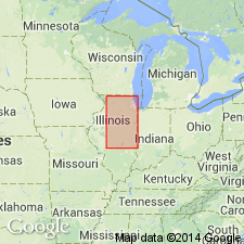
Named as member of Glasford Formation (new) for Kellerville, Adams Co, IL. Type section is roadcut exposures 2 mi southwest of Kellerville in Washington Grove Section, NW NW SW sec 11, T2S, R5W. Replaces the term Mendon Till (Frye and others, 1964; Frye and others, 1969); name Mendon retained for Mendon Moraine. Replaces the name Payson Till (Leighton and Willman, 1950; Wanless, 1957). Consists of till with intercalated discontinuous zones of sand and gravel outwash and silt; it is more variable than overlying tills and commonly has greater percentage of expandable clay minerals. Is as thick as 150 ft in deeper bedrock valleys, but is more commonly 50-100 ft thick. Geographic extent shown in fig 6 (western Illinois basin and southern part of Wisconsin arch). Spatial relationship shown on fig 7. Grain-size and composition given in tables 2, 4, and 5. Is bounded at base by Petersburg Silt or, in its absence, by the top of the Yarmouth Soil. Upper limit is the top of the Pike Soil (new), the Duncan Mills Member (new), the Teneriffe Silt (new), or younger units. Is in the upper part of the Liman Substage of the Illinoian Stage. Was deposited by the westernmost extension of the Lake Michigan Lobe.
Source: GNU records (USGS DDS-6; Denver GNULEX).
For more information, please contact Nancy Stamm, Geologic Names Committee Secretary.
Asterisk (*) indicates published by U.S. Geological Survey authors.
"No current usage" (†) implies that a name has been abandoned or has fallen into disuse. Former usage and, if known, replacement name given in parentheses ( ).
Slash (/) indicates name conflicts with nomenclatural guidelines (CSN, 1933; ACSN, 1961, 1970; NACSN, 1983, 2005, 2021). May be explained within brackets ([ ]).

