- Usage in publication:
-
- Keller group
- Modifications:
-
- Named
- Dominant lithology:
-
- Limestone
- Shale
- Sandstone
- Conglomerate
- AAPG geologic province:
-
- Orogrande basin
- San Juan basin
Summary:
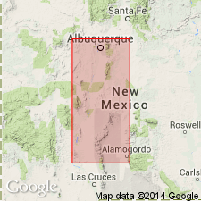
Named as lower of two groups of Virgil series for Keller Spring, 2 mi east of South Oscura Peak, Oscura Mountains, NM and divided into Del Cuerto formation (new, at base) and Moya formation (new, at top). Type locality is section measured mainly in NE1/4 sec 31, T5S, R6E, and extends a short distance into west-central part of sec 32, in north end of Oscura Mountains, Socorro Co, NM in Orogrande basin. Overlies Story formation of Hansonburg group (both new) of Missouri series; underlies Bruton formation of Fresnal group (both new). Contains two distinct lithologies: 1) lower unit (Del Cuerto) is about 81 ft thick and is composed of numerous nodular to irregularly bedded limestones, interbedded with calcareous shales, arkosic sandstones, and conglomerates; 2) upper unit (Moya), about 51 ft thick, is composed almost entirely of massive to irregularly bedded light-gray limestone. Lithology of group varies locally. Keller is widespread in NM; equivalent rocks found over most of central and southern parts of State. Also identified in deep wells in east-central NM, in San Juan basin. Fossiliferous, containing fusulinids typical of lower Virgil series over much of NM. Mostly genus TRITICITES, but some representatives of genus DUNBARINELLA abundant in some areas, especially north Sacramento Mountains, Otero Co. Is of Pennsylvanian, (Virgil) age.
Source: GNU records (USGS DDS-6; Denver GNULEX).
For more information, please contact Nancy Stamm, Geologic Names Committee Secretary.
Asterisk (*) indicates published by U.S. Geological Survey authors.
"No current usage" (†) implies that a name has been abandoned or has fallen into disuse. Former usage and, if known, replacement name given in parentheses ( ).
Slash (/) indicates name conflicts with nomenclatural guidelines (CSN, 1933; ACSN, 1961, 1970; NACSN, 1983, 2005, 2021). May be explained within brackets ([ ]).

