

- Usage in publication:
-
- Kekiktuk Conglomerate*
- Modifications:
-
- Named
- Dominant lithology:
-
- Conglomerate
- AAPG geologic province:
-
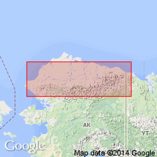
- Alaska Northern region
Summary:
Pg. 2174, 2177 (fig. 2), 2183, 2185, 2186, 2195. Kekiktuk Conglomerate. Composed of predominantly conglomerate and gray coarse-grained quartzitic sandstone. Thickness 0 to more than 400 feet; commonly less than 300 feet; at type section 295 feet. May in part thin and disappear by grading laterally into basal sandstone beds of Kayak(?) Shale. Unconformably overlies Neruokpuk Formation at many places. The Kekiktuk is probably basal conglomerate of overlapping Mississippian sequence; may become progressively younger northeastward. Lithologically similar to [Kanayut] Conglomerate and occupies similar place in sequence of formations but Kanayut is not known to have unconformity at base. If the two conglomerates are the same, they may be inferred to overlap progressively on an Upper Devonian unconformity in northeast part of area. Contains indeterminate plant fragments. Age is Late(?) Devonian or Mississippian.
Type section: exposures on mountain side west of Whistler Creek, Lat. 69 deg. 19 min. N., Long. 145 deg. 09 min. W., 3.5 mi above mouth of Whistler Creek, near Lake Peters, AK. Named for stream [Kekiktuk Creek] that drains Lake Peters.
Source: US geologic names lexicon (USGS Bull. 1350, p. 384-385); supplemental information from GNU records (USGS DDS-6; Menlo GNULEX).

- Usage in publication:
-
- Kekiktuk Conglomerate*
- Modifications:
-
- Revised
- AAPG geologic province:
-
- Alaska Northern region
Summary:
Assigned to Endicott Group (new) as second from uppermost formation in Romanzof Mountains. Is widely though discontinuously distributed unit in northeast Brooks Range. Is thin unit (0-100 m) deposited in a paralic environment. Disconformably overlies Neruokpuk Formation. Gradationally underlies Kayak(?) Shale of Endicott Group. Age assigned is Late(?) Devonian or Mississippian age in part because it appears to transgress time. "It may be entirely Mississippian."
Source: Modified from GNU records (USGS DDS-6; Menlo GNULEX).
- Usage in publication:
-
- Kekiktuk Conglomerate*
- Modifications:
-
- Age modified
- AAPG geologic province:
-
- Alaska Northern region
Summary:
Fauna indicate Mississippian age for formation. Composed of angular quartz conglomerate to quartzitic sandstone. Lithologic and depositional character suggest channel-like depositional environment. Coal and carbonized wood fragments persistently occur.
Source: GNU records (USGS DDS-6; Menlo GNULEX).
- Usage in publication:
-
- Kekiktuk Conglomerate*
- Modifications:
-
- Age modified
- AAPG geologic province:
-
- Alaska Northern region
Summary:
Consists of three, interbedded, low-grade metasedimentary rock units: a semi-schistose chlorite-muscovite-quartz metasandstone and metaconglomerate; chloritoid-bearing semi-schistose metaquartzite and quartz mylonite; and a calcareous feldspathic chlorite muscovite-quartz semi-schistose metasandstone and metaconglomerate. Maximum thickness is 200 m. Underlies Kayak Shale. Overlies Kanayut Conglomerate. Age shown on correlation chart is Early Mississippian.
Source: Modified from GNU records (USGS DDS-6; Menlo GNULEX).
- Usage in publication:
-
- Kekiktuk Conglomerate*
- Modifications:
-
- Overview
- AAPG geologic province:
-
- Alaska Northern region
Summary:
Type section remeasured (Nilsen and others 1981). Consists of three informal units (ascending): basal breccia and conglomerate 1 to 3 m thick that consist of weathered angular blocks of locally underlying basement and some rounded pebbles of quartz, quartzite, and chert; massive outcropping fining upward couplets of conglomerate and sandstone 58 m thick; and several fining upward cycles of conglomerate, sandstone, and shale, 20 m thick. Total thickness at type is 80 m. Overlies pre-Mississippian granite and basement rocks in northeast Brooks Range. Gradationally underlies Kayak Shale (Endicott Group). Age is Early Mississippian. Formation was deposited in fluvial environment.
Source: GNU records (USGS DDS-6; Menlo GNULEX).
- Usage in publication:
-
- Kekiktuk Conglomerate*
- Modifications:
-
- Biostratigraphic dating
- AAPG geologic province:
-
- Alaska Northern region
Summary:
Age is considered Early Mississippian (Kinderhookian), in eastern Brooks Range, based on revised megafossil zonations. Fossils include plants, and trace fossils SCALARITUBA and SKOLITHOS. Assemblages are Kinderhookian in age.
Source: Modified from GNU records (USGS DDS-6; Menlo GNULEX).
For more information, please contact Nancy Stamm, Geologic Names Committee Secretary.
Asterisk (*) indicates published by U.S. Geological Survey authors.
"No current usage" (†) implies that a name has been abandoned or has fallen into disuse. Former usage and, if known, replacement name given in parentheses ( ).
Slash (/) indicates name conflicts with nomenclatural guidelines (CSN, 1933; ACSN, 1961, 1970; NACSN, 1983, 2005, 2021). May be explained within brackets ([ ]).