The National Geologic Map Database is migrating to a new infrastructure. We apologize for any service disruptions during this process.
|
|---|


- Usage in publication:
-
- Keene Member
- Modifications:
-
- Named
- Dominant lithology:
-
- Till
- AAPG geologic province:
-
- Wisconsin arch
Summary:
Keene Member of Horicon Formation is here named for community of Keene in Portage Co. Unit includes brown or reddish brown unbedded noncalcareous and slightly calcareous till of the Arnott moraine deposited by Green Bay Lobe. Consists of 2 to 20 percent gravel, 65 to 85 percent sand, 5 to 25 percent silt, and 8 to 17 percent clay. Underlies and overlies undifferentiated sands of the Horicon Formation though it is presumed to underlie Mapleview Member in the eastern part of the county. Thickness ranges from 10 to 30 m. The Keene may be several times older than the Mapleview and is considered to be pre-Wisconsinan.
Source: GNU records (USGS DDS-6; Reston GNULEX).
- Usage in publication:
-
- Keene Member
- Modifications:
-
- Overview
- Dominant lithology:
-
- Till
- Sand
- Silt
- Clay
- AAPG geologic province:
-
- Wisconsin arch
Summary:
Pg. vi (chart), 25-27; see Clayton, Lee, 1986, Wisconsin Geol. Nat. Hist. Survey Inf. Circ., no. 56, 19 p. Keene Member of Horicon Formation. Till. Brown or reddish-brown, unbedded, slightly gravelly to gravelly, sandy loam and loamy sand. Basal 4+/- m is slightly gravelly to gravelly sand. Total thickness typically 10 to 30 m. Is a surface unit limited to type area. Overlies sand of Horicon Formation. Interpreted to be till of an end moraine formed by Green Bay Lobe during the Arnott Glaciation (undated). Age is considered Pleistocene (possibly pre-Wisconsinan or early Wisconsinan), based on degree of weathering and erosion.
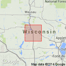
Type section (subsurface): auger hole in south side of SE/4 lot 23, sec. 30, T. 22 N., R. 9 E., [on north side of County Trunk Highway N, west of WI State Highway 51, Buena Vista Twp.], in SE/4 SW/4 SW/4 E/2 sec. 30, T. 22 N., R. 9 E., [approx. Lat. 44 deg. 21 min. 06 sec. N., Long. 89 deg. 27 min. 44 sec. W.], Almond 7.5-min quadrangle, Portage Co., central WI.
Named from community of Keene [northwest of type section], northwestern edge Almond 7.5-min quadrangle, Portage Co., central WI.
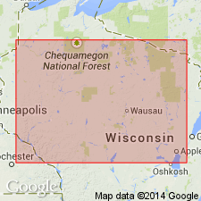
Reference section: auger hole in NE/4 lot. 5 sec. 19 T. 23 N., R. 9 E., [near junction of two unnamed roads northwest of Arnott, Stockton Twp.], in NE/4 NE/4 NE/4 W/2 sec. 19, T. 23 N., R. 9 E., [approx. Lat. 44 deg. 28 min. 03 sec. N., Long. 88 deg. 28 min. 03 sec. W.], Arnott 7.5-min quadrangle, Portage Co., central WI.
[Additional locality information from Ownership Plat Book of Portage County, Wisconsin, www.digicoll.library.wisc.edu, USGS historical topographic map collection TopoView, and Wisconsin Highways, www.wisconsinhighways.org; accessed on June 9, 2018.]
Source: Publication.
- Usage in publication:
-
- Keene Member
- Modifications:
-
- Revised
- Dominant lithology:
-
- Till
- Sand
- Silt
- Clay
- AAPG geologic province:
-
- Wisconsin arch
Summary:
Pg. 5 (fig. 3), 12; App., p. 51, 52 (fig. A2). Keene Member of Holy Hill Formation. Recognized locally in the Green Bay Lobe, west of Kettle Moraine, Portage County, east-central Wisconsin. Previously a member of Horicon Formation (Mickelson and others, 1984). [Age of Holy Hill Formation is Pleistocene (late Wisconsinan, approximately 18,000 to 13,000 yr B.P.), based on stratigraphic relations.]
Source: Publication.
For more information, please contact Nancy Stamm, Geologic Names Committee Secretary.
Asterisk (*) indicates published by U.S. Geological Survey authors.
"No current usage" (†) implies that a name has been abandoned or has fallen into disuse. Former usage and, if known, replacement name given in parentheses ( ).
Slash (/) indicates name conflicts with nomenclatural guidelines (CSN, 1933; ACSN, 1961, 1970; NACSN, 1983, 2005, 2021). May be explained within brackets ([ ]).