- Usage in publication:
-
- Kearsarge Formation*
- Modifications:
-
- Original reference
- Biostratigraphic dating
- Dominant lithology:
-
- Shale
- Limestone
- Siltstone
- Breccia
- AAPG geologic province:
-
- Great Basin province
Summary:
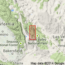
Pg. J5 (fig. 3), J18 (fig. 13), J19-J22, J29, J38-J39. Kearsarge Formation. Divided into (descending) Upper Mississippian Snowcaps Member and Lower Mississippian Bee Member (both new); [members separated by hiatus approx. = Osagean]. Thickness at type 153.5 m; ranges from about 47 to 154 m. Conformably underlies Rest Spring Shale. Unconformably overlies Upper Devonian Squares Tunnel Formation (new); locally unconformably overlies the Devonian upper part of Vaughn Gulch Limestone. Present in northwestern-facies belt (base-of-slope and deep basinal environments), notably the Vaughn Gulch area, Inyo County, eastern California. Rocks previously included in Perdido Formation by some geologists. Age is Early Mississippian (late Kinderhookian; Lower CRENULATA zone of Poole and Sandberg, 1991) and Late Mississippian (late Meramecian to early Chesterian; Lower CAVUSGNATHUS to BILINEATUS-Upper CAVUSGNATHUS zone of Poole and Sandberg, 1991).
Type section: on ridge on south side of Vaughn Gulch, about 11.5 km east of Independence, west side of Inyo Mountains, [in NW/4 SW/4 sec. 9, T. 13 S., R. 36 E., approx. Lat. 36 deg. 49 min. 00 sec. N., Long. 118 deg. 04 min. 18 sec. W., Bee Springs Canyon 7.5-min quadrangle, 1994 ed.], Inyo Co., eastern CA. Named for site of railroad station that once stood next to the Mazourka Canyon Road, near town of Independence, Bee Springs Canyon 7.5-min quadrangle, Inyo Co., eastern CA.
Source: Publication.
For more information, please contact Nancy Stamm, Geologic Names Committee Secretary.
Asterisk (*) indicates published by U.S. Geological Survey authors.
"No current usage" (†) implies that a name has been abandoned or has fallen into disuse. Former usage and, if known, replacement name given in parentheses ( ).
Slash (/) indicates name conflicts with nomenclatural guidelines (CSN, 1933; ACSN, 1961, 1970; NACSN, 1983, 2005, 2021). May be explained within brackets ([ ]).

