The National Geologic Map Database is migrating to a new infrastructure. We apologize for any service disruptions during this process.
|
|---|


- Usage in publication:
-
- Keanakakoi formation
- Modifications:
-
- Named
- Dominant lithology:
-
- Ash
- AAPG geologic province:
-
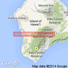
- Hawaii
Summary:
Named for exposures near pit crater of Keanakakoi, Island of Hawaii. Previously referred to as "ash of 1790", "ash of 1924", and their earlier analogues. Forms thin surface cover over the region closely surrounding Kilauea caldera. Includes lapilli, dust formed by phreatic explosions, reticulite, and ejecta formed by magmatic explosions. Has maximum thickness of 30 ft on tongue of caldera rim that extends W from Keanakakoi Crater. Measured sections on SE Kileau rim trail S of Lua Manu Crater, edge of Waldron Ledge 2000 ft S of Volcano House, W side of Volcano House, Kau Rd, and near Halfway House. Interbedded with secondary eolian and slope-washed material from Pahala tuff. Oldest ash estimated to be not over 500 yrs. old based on study of forests and trees. [see Stearns and Macdonald, 1946, p.101]
Source: GNU records (USGS DDS-6; Menlo GNULEX).
- Usage in publication:
-
- Keanakakoi member
- Modifications:
-
- Revised
- AAPG geologic province:
-
- Hawaii
Summary:
Wentworth (1938) proposed "name Keanakakoi formation to include this entire complex of surface ash deposits but herein it is treated simply as the aa [ash] member of the Puna volcanic series."
Source: GNU records (USGS DDS-6; Menlo GNULEX).
- Usage in publication:
-
- Keanakakoi formation
- Modifications:
-
- Age modified
- AAPG geologic province:
-
- Hawaii
Summary:
Measured section described for four of the series (19 layers, 1-k thru 19-k) of Keanakakoi eruptions. "An estimate of perhaps 1,500 years is suggested for the total time covering the explosive eruptions of the Keanakakoi formation". p.290
Source: GNU records (USGS DDS-6; Menlo GNULEX).
- Usage in publication:
-
- Keanakakoi formation*
- Modifications:
-
- Mapped
- AAPG geologic province:
-
- Hawaii
Summary:
Map shows pyroclastic deposits blanket area near Kilauea caldera. Is as much as 35 ft thick SW of caldera. "Most of this ash is part of the Keanakakoi Formation of Wentworth (1938)."
Source: GNU records (USGS DDS-6; Menlo GNULEX).
- Usage in publication:
-
- Keanakakoi Formation
- Modifications:
-
- Geochronologic dating
- AAPG geologic province:
-
- Hawaii
Summary:
Carbon-14 age for layer 3-k (of Powers, 1948) is 2500 +/-250 yr B.P. (Rubin and Suess, 1956). Since "layer 1-k is probably not much older than layer 3-k", total accumulated interval extends from 2500 to 1790 yr B.P.
Source: GNU records (USGS DDS-6; Menlo GNULEX).

- Usage in publication:
-
- Keanakakoi Ash
- Modifications:
-
- Geochronologic dating
- AAPG geologic province:
-
- Hawaii
Summary:
Carbonaceous soil and charcoal at base of pyroclastic sequence underlying basal reticulite of Keanakakoi Ash in pit in Alaa Forest Reserve on Wright Road was dated at 340 +/-60 yr B.P. by carbon-14 method.
Source: GNU records (USGS DDS-6; Menlo GNULEX).

- Usage in publication:
-
- Keanakakoi Member
- Modifications:
-
- Revised
- AAPG geologic province:
-
- Hawaii
Summary:
Stratigraphic column shows Keanakakoi Member [formerly Keanakakoi Formation] to be youngest member of Puna Formation.
Source: GNU records (USGS DDS-6; Menlo GNULEX).
- Usage in publication:
-
- Keanakakoi Formation
- Modifications:
-
- Areal extent
- AAPG geologic province:
-
- Hawaii
Summary:
Stratigraphic descriptions of the 1790 basaltic tephra of Keanakakoi Formation informally divides it into upper lithic (1 mm to 7 m thick), intermediate vitric (as much as 2 m thick), and lower mixed (up to 2 m thick) units in Kau Desert, a 350 sq km wedge apexing at Kilauea caldera.
Source: GNU records (USGS DDS-6; Menlo GNULEX).

- Usage in publication:
-
- Keanakakoi Formation
- Modifications:
-
- Overview
- AAPG geologic province:
-
- Hawaii
Summary:
Idealized [composite] stratigraphic section of Keanakakoi Formation is given. Mainly represents explosive eruption of 1790 A.D. but has slightly older reticulite pumice at base. Six major informal units separated by truncated surfaces are recognized. Age of unit is given as 192 yrs. (1790 A.D.).
Source: GNU records (USGS DDS-6; Menlo GNULEX).
- Usage in publication:
-
- Keanakakoi Ash Member*
- Modifications:
-
- Overview
Summary:
Suite A, B, and C flows recognized in detailed section of Keanakakoi Ash Member at Uwekahuna Bluff section, Kilauea caldera, Hawaii.
Source: GNU records (USGS DDS-6; Menlo GNULEX).
- Usage in publication:
-
- Keanakakoi Ash Member*
- Modifications:
-
- Revised
- AAPG geologic province:
-
- Hawaii
Summary:
Keanakakoi Formation (as described by Decker and Christiansen, 1984) is reduced in rank and renamed Keanakakoi Ash Member of Puna Basalt.
Source: GNU records (USGS DDS-6; Menlo GNULEX).

- Usage in publication:
-
- Keanakakoi Ash Member*
- Modifications:
-
- Revised
- AAPG geologic province:
-
- Hawaii
Summary:
Reduced in rank and renamed to indicate lithology. Formerly Keanakakoi Formation (part) (Wentworth, 1938; Powers, 1948); "aa" [erroneously for ash?] member (part) of Puna Volcanic Series (Stearns and Macdonald, 1946, p.108); Keanakakoi Formation (part) of Puna Volcanic Series (Davis and Macdonald IN Avias and others, 1956); Keanakakoi Member (part) of Puna Formation (Easton and Garcia, 1980); (partly) Keanakakoi Formation (Malin and others, 1983). Is youngest (historic) member of Puna Basalt. Type locality SW of Keanakakoi crater. Maximum exposed thickness is 11 m. Is interbedded with historic Puna Basalt lava flows. (See Easton, 1987, this volume).
Source: GNU records (USGS DDS-6; Menlo GNULEX).
For more information, please contact Nancy Stamm, Geologic Names Committee Secretary.
Asterisk (*) indicates published by U.S. Geological Survey authors.
"No current usage" (†) implies that a name has been abandoned or has fallen into disuse. Former usage and, if known, replacement name given in parentheses ( ).
Slash (/) indicates name conflicts with nomenclatural guidelines (CSN, 1933; ACSN, 1961, 1970; NACSN, 1983, 2005, 2021). May be explained within brackets ([ ]).