The National Geologic Map Database is migrating to a new infrastructure. We apologize for any service disruptions during this process.
|
|---|


- Usage in publication:
-
- Kaupo mud flow*
- Modifications:
-
- Named
- Dominant lithology:
-
- Breccia
- AAPG geologic province:
-
- Maui
Summary:
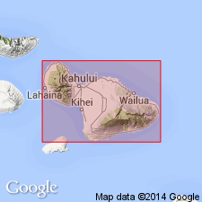
Named for Kaupo Valley [20 deg 38' 22"N, 156 deg 07' 31"W, Kaupo 7.5' quad] south side of Island of Maui. Crops out over 1.5 sq mi at mouth of valley. Projects through some Hana lavas. Composed of firmly cemented impermeable breccia with angular and subangular debris with blocks up to 50 ft across. Has 355 ft of exposed thickness at Puu Maneoneo. Base not exposed. Extends below present sea level. Probably flowed during Kahipa -300 ft stand of sea. Map shows Pleistocene and Recent age.
Source: GNU records (USGS DDS-6; Menlo GNULEX).
- Usage in publication:
-
- Kaupo mud flow*
- Modifications:
-
- Age modified
- AAPG geologic province:
-
- Maui
Summary:
"Later than some of the Hana volcanic series." Assigned Pleistocene age. [listed as unit within Hana volcanic series on p. 86]
Type locality: mouth of Kaupo Valley [Lat. 20 deg. 38 min. 22 sec. N., Long. 156 deg. 07 min. 31 sec. W., Kaupo 7.5-min quadrangle] on southern side of Island of Maui, HI.
Source: GNU records (USGS DDS-6; Menlo GNULEX).
For more information, please contact Nancy Stamm, Geologic Names Committee Secretary.
Asterisk (*) indicates published by U.S. Geological Survey authors.
"No current usage" (†) implies that a name has been abandoned or has fallen into disuse. Former usage and, if known, replacement name given in parentheses ( ).
Slash (/) indicates name conflicts with nomenclatural guidelines (CSN, 1933; ACSN, 1961, 1970; NACSN, 1983, 2005, 2021). May be explained within brackets ([ ]).