The National Geologic Map Database is migrating to a new infrastructure. We apologize for any service disruptions during this process.
|
|---|


- Usage in publication:
-
- Katalla formation*
- Modifications:
-
- Original reference
- Biostratigraphic dating
- Dominant lithology:
-
- Shale
- Sandstone
- Limestone
- Conglomerate
- Ash
- AAPG geologic province:
-
- Alaska Southern region
Summary:
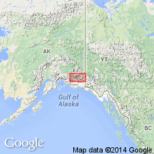
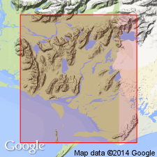
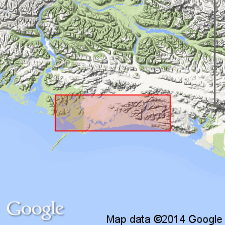
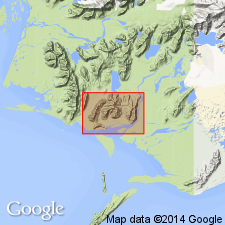
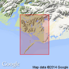
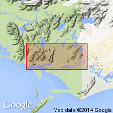
Pg. 13. Katalla formation. Series of dark, argillaceous and carbonaceous shales, with occasional bands of sandstone, limestone, conglomerate, and volcanic ash. Petroliferous. Typically exposed in region northeast of Katalla, [Katalla district, Controller Bay region, southeastern Alaska], along banks of Katalla River, in range of hills to southeast, whence it extends eastward, occupying whole of peninsula between Bering Lake and Controller Bay and cropping out in most of hills south and east of Bering River. Good exposures on western shore of Bering Lake. The few fossils indicate Tertiary age, probably Eocene. Is probably overlain by Kushtaka formation, of probable Oligocene age. Thickness undetermined.
Source: US geologic names lexicon (USGS Bull. 896, p. 1074).
- Usage in publication:
-
- Katalla formation*
- Modifications:
-
- Areal extent
- AAPG geologic province:
-
- Alaska Southern region
Summary:
Pg. 24, 27. Katalla formation. Gave thickness of the 5 members of Katalla formation in Controller Bay region, which aggregate 6,500 feet, and stated that "position of formation with reference to other Tertiary formations is not definitely established," but in columnar section he placed a new formation, named Stillwater, between the Katalla and the Kushtaka formation. The Katalla formation occurs to south of Bering Lake, the Stillwater, Kushtaka, and Tokun to north of Bering Lake.
Source: US geologic names lexicon (USGS Bull. 896, p. 1074).
- Usage in publication:
-
- Katalla formation
- Modifications:
-
- Revised
- Age modified
- AAPG geologic province:
-
- Alaska Southern region
Summary:
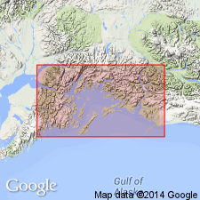
Pg. 771-782. Writer has divided the marine Katalla formation of Martin into 2 formations, largely on basis of lithology. There is no stratigraphic break between the 2 formations, but a decided change in lithology. The lower, 3,600+ feet thick, is here called Katalla formation; the upper, 5,100+/- feet thick, is here named Redwood formation. The Katalla is further divided into Burls Creek shale member above and Split Creek shale and sandstone below. It occupies fully 85 percent of Katalla district; the Redwood is restricted to a broad, steeply plunging syncline between Redwood and Burls Creeks and to ridge between Cave and Hey Points. Fossils rare and as a rule poorly preserved, but the sediments are similar lithologically to the fossiliferous beds of Yakataga district, which are pronounced by B.L. Clark to be upper Oligocene, and they are therefore here assigned to upper Oligocene. The Katalla and Redwood formations are also well developed in Nichawak district, [Controller Bay region, southeastern Alaska].
[GNC remark (ca. 1936, US geologic names lexicon, USGS Bull. 896, p. 1074): The USGS classifies typical Katalla formation as Miocene(?).]
Source: US geologic names lexicon (USGS Bull. 896, p. 1074).
- Usage in publication:
-
- Katalla formation*
- Modifications:
-
- Revised
- Dominant lithology:
-
- Shale
- Sandstone
- Conglomerate
- AAPG geologic province:
-
- Alaska Southern region
Summary:
Pg. 6-8, geol. map. Katalla formation. Consists of about 8,600 feet of marine shale, sandstone, and conglomerate in Katalla area, southeastern Alaska. Compiled from continuous, apparently conformable, section measured from Split Creek southward along Redwood Creek-Burls Creek divide and Redwood Creek-Puffy Creek divide to point near southern end of latter divide. Divided into seven members (ascending): unnamed shale, Split Creek, Basin Creek, Burls Creek, unnamed organic shale, Point Hey, and Puffy. Measured section in many respects representative of average thickness and lithology of formation as exposed in Katalla area. Age is considered Oligocene(?).
Source: US geologic names lexicon (USGS Bull. 1200, p. 1973).
- Usage in publication:
-
- Katalla formation*
- Modifications:
-
- Mapped
- Dominant lithology:
-
- Shale
- Sandstone
- Conglomerate
- AAPG geologic province:
-
- Alaska Southern region
Summary:
Pg. 21+, pls. Katalla formation [= classification of Miller and others, 1945, USGS OF-45-103]. Consists of about 8,700 feet of marine shale, sandstone and conglomerate. Section measured from Split Creek southward along Redwood Creek-Burls Creek divide and Redwood-Puffy Creek divide to point near southern end of latter divide. Subdivided into (ascending): unnamed shale member, Split Creek sandstone member, Basin Creek member, Burls Creek shale member, organic shale member, Point Hey member, and Puffy member. [Age is considered Oligocene and possibly Miocene.]
Recognized in Martin Lakes, Katalla, Nichawak, Kayak Island, and Suckling Hills areas, Controller Bay region, southeastern AK.
Source: Modified from GNU records (USGS DDS-6; Menlo GNULEX).
- Usage in publication:
-
- Katalla Formation*
- Modifications:
-
- Revised
- Age modified
- Adopted
- AAPG geologic province:
-
- Alaska Southern region
Summary:
Katalla Formation. Stratigraphically restricted to strata between Tokun and Redwood Formations. Strata previously assigned to basal unnamed shale member of Katalla are now included in underlying Tokun. †Point Hey Member of Katalla abandoned; upper part (sandstones) reassigned to overlying Redwood, and lower part (interbedded shale and sandstone) reassigned to Burls Creek Shale Member. Puffy Member, previously uppermost member of Katalla, is reassigned to the Redwood. As restricted, Katalla includes (ascending) Split Creek Sandstone Member (middle Oligocene), Basin Creek Member (middle Oligocene), and Burls Creek Shale Member (late? Oligocene). Maximum total thickness 5,190 feet. Age changed from Oligocene and Miocene --to-- middle and late(?) Oligocene. [See correlation chart.]
Source: Publication; GNU records (USGS DDS-6; Menlo GNULEX); Changes in stratigraphic nomenclature, 1976 (USGS Bull. 1435-A, p. A49).
- Usage in publication:
-
- Katalla Formation†
- Modifications:
-
- Abandoned
- AAPG geologic province:
-
- Alaska Southern region
Summary:
Katalla Formation is equivalent of Poul Creek Formation in adjacent Yakataga district. Katalla is abandoned; its rocks [and consequently its members] are reassigned to Poul Creek Formation.
Source: GNU records (USGS DDS-6; Menlo GNULEX).
For more information, please contact Nancy Stamm, Geologic Names Committee Secretary.
Asterisk (*) indicates published by U.S. Geological Survey authors.
"No current usage" (†) implies that a name has been abandoned or has fallen into disuse. Former usage and, if known, replacement name given in parentheses ( ).
Slash (/) indicates name conflicts with nomenclatural guidelines (CSN, 1933; ACSN, 1961, 1970; NACSN, 1983, 2005, 2021). May be explained within brackets ([ ]).