

- Usage in publication:
-
- Kaskaskia sequence
- Modifications:
-
- Named
- AAPG geologic province:
-
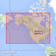
- Illinois basin
- North America
Summary:
Is name proposed for third (of four, ascending) Paleozoic sequence, for the Kaskaskia River in south-central IL, in Illinois basin. Sequences ("operational units" established to facilitate interregional facies mapping) are assemblages of strata separated by objective horizons; should be considered as rock units, assemblages of formations and groups. Within the Kaskaskia drainage basin many thoroughly logged and sampled wells penetrate a typical development of the sequence from the base of Aux Vases sandstone to base of Wapsipinicon and other formations resting on lower Devonian and Silurian strata. Table 2 shows formations involved in limits of Kaskaskia at various localities on mid-America craton. Age of strata in the sequence in most cases is Chautauquan (Late Devonian) to Osagean (Early Mississippian).
Source: GNU records (USGS DDS-6; Denver GNULEX).
For more information, please contact Nancy Stamm, Geologic Names Committee Secretary.
Asterisk (*) indicates published by U.S. Geological Survey authors.
"No current usage" (†) implies that a name has been abandoned or has fallen into disuse. Former usage and, if known, replacement name given in parentheses ( ).
Slash (/) indicates name conflicts with nomenclatural guidelines (CSN, 1933; ACSN, 1961, 1970; NACSN, 1983, 2005, 2021). May be explained within brackets ([ ]).