The National Geologic Map Database is migrating to a new infrastructure. We apologize for any service disruptions during this process.
|
|---|


- Usage in publication:
-
- Kaskaskia group
- Modifications:
-
- Revised
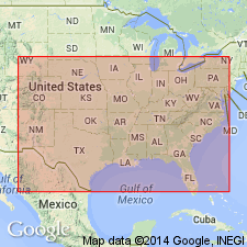
- Areal extent
- AAPG geologic province:
-
- Illinois basin
- Ozark uplift
Summary:
Divided into three formations which are, in ascending order, Aux Vases sandstone (new), Kaskaskia limestone [same name should not be used for both group and a constituent formation], and Chester shales (both Kaskaskia limestone and Chester shales are of local usage). Chester has been used by some authors for rocks here called Kaskaskia; Kaskaskia has precedence over Chester. Kaskaskia occurs in southern IL, Illinois basin and southeastern MO, Ozark uplift; no Kaskaskia rocks occur north of Missouri River. Overlies St. Louis group; is youngest Mississippian group discussed.
Source: GNU records (USGS DDS-6; Denver GNULEX).
For more information, please contact Nancy Stamm, Geologic Names Committee Secretary.
Asterisk (*) indicates published by U.S. Geological Survey authors.
"No current usage" (†) implies that a name has been abandoned or has fallen into disuse. Former usage and, if known, replacement name given in parentheses ( ).
Slash (/) indicates name conflicts with nomenclatural guidelines (CSN, 1933; ACSN, 1961, 1970; NACSN, 1983, 2005, 2021). May be explained within brackets ([ ]).