

- Usage in publication:
-
- Kanayut conglomerate*
- Modifications:
-
- Named
- Dominant lithology:
-
- Conglomerate
- Sandstone
- Shale
- AAPG geologic province:
-
- Alaska Northern region
Summary:
Named Kanayut conglomerate. Divided into (ascending): unnamed informal lower member, 1,400 feet thick; unnamed informal middle member, massive chert pebble conglomerate, 1,030 feet thick; and Stuver Member, about 800 feet of orthoquartzite, gray, red and green shale, and conglomerate. Composite thickness is 3,300 feet. Disconformably underlies Kayak shale (new). Overlies unnamed shale and sandstone. Age is Late Devonian.
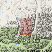
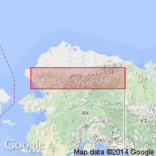
Type locality: exposures on ridge, east of Alapah Creek, south of Mount Wachsmuth, Shainin Lake area, central Brooks Range, [approx. Lat. 68 deg. 18 min. N., Long. 150 deg. 55 min. W.] AK. Named from Kanayut River which originates at north end of Shainin Lake.
Source: Modified from GNU records (USGS DDS-6; Menlo GNULEX).
- Usage in publication:
-
- Kanayut Conglomerate*
- Modifications:
-
- Areal extent
- AAPG geologic province:
-
- Alaska Northern region
Summary:
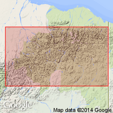
Kanayut Conglomerate has been mapped eastward in a continuous belt from type area to eastern Brooks Range. Composed of quartzitic sandstone and quartz and chert-pebble conglomerate, with conglomerate most persistent and abundant in lower part of formation. Best exposures occur along southern margin of belt between Wind and Sheenjek Rivers. Thickness ranges from 100 to 5,000 feet. Overlies unnamed slate-sandstone unit. Underlies Kayak Shale. Age is Late Devonian.
Source: GNU records (USGS DDS-6; Menlo GNULEX).
- Usage in publication:
-
- Kanayut conglomerate*
- Modifications:
-
- Areal extent
- AAPG geologic province:
-
- Alaska Northern region
Summary:
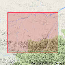
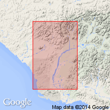
Kanayut conglomerate now recognized in southern part of Killik-Etivluk Rivers region of central Brooks Range, west of type locality. Measured sections: mountains on east side of Killik River [Lat. 68 deg. 25 min. N., Long. 154 deg. 01 min. W.]; and along Etivluk River to Howard Pass [Lat. 69 deg. 07 min. N., Long. 156 deg. 50 min. W.]. Field studies indicate southern part of mapped area is less conglomeratic than north. Age is Late Devonian.
Source: GNU records (USGS DDS-6; Menlo GNULEX).

- Usage in publication:
-
- Kanayut Conglomerate*
- Modifications:
-
- Revised
- AAPG geologic province:
-
- Alaska Northern region
Summary:
Kanayut Conglomerate assigned to Endicott Group (new) as second from lowermost of three formations in type area of Endicott Group; [group includes five formations overall]. Depositional features and plant detritus suggest paralic environment. Formation seems to pinch out at 68th parallel. Overlies Hunt Fork Shale (Endicott Group). Underlies Kayak Shale (Endicott Group). Chart shows correlation with Noatak Sandstone in DeLong Mountains and maybe with Kekiktuk Conglomerate in Romanzof Mountains (both of Endicott Group). Age is Late Devonian.
Source: GNU records (USGS DDS-6; Menlo GNULEX).
- Usage in publication:
-
- Kanayut Conglomerate*
- Modifications:
-
- Age modified
- AAPG geologic province:
-
- Alaska Northern region
Summary:
Consists of (ascending): lower shale member, middle conglomerate member (both informal), and Stuver Member. Plant fossils generally indicate Late Devonian age; some plant fossils from upper parts of formation suggest Early Mississippian age. Age assigned to the Kanayut is Late Devonian and Early Mississippian(?).
Source: GNU records (USGS DDS-6; Menlo GNULEX).
- Usage in publication:
-
- Kanayut Conglomerate*
- Modifications:
-
- Revised
- AAPG geologic province:
-
- Alaska Northern region
Summary:
Kanayut Conglomerate previously divided into four members (three informal and one formal) (Porter, 1966; Brosge and others 1979; Nilsen and others 1980, 1981) is stratigraphically restricted to consist of three formal members of fluvial origin (ascending): Ear Peak Member (new), Shainin Lake Member (new), and Stuver Member. An informal marine basal sandstone member is restricted from Kanayut and assigned to marine Noatak Sandstone. Composed of (ascending): sequence of fining-upward fluvial cycles of conglomerate, sandstone, and shale, as thick as 1160 m, deposited by meandering streams; a sequence of fining-upward couplets of conglomerate and sandstone, as thick as 530 m, deposited by braided streams; and a sequence of fining upward fluvial cycles of conglomerate, sandstone, and shale as thick as 1300 m, deposited by meandering streams. Age is Late Devonian and Early Mississippian(?).
Source: GNU records (USGS DDS-6; Menlo GNULEX).
- Usage in publication:
-
- Kanayut Conglomerate*
- Modifications:
-
- Areal extent
- AAPG geologic province:
-
- Alaska Northern region
Summary:
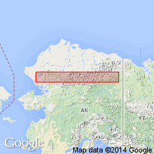
Kanayut Conglomerate geographically extended into Husky Mountains and Mulgrave Hills, westernmost margin of Brooks Range, in De Long Mountains and Noatak quadrangles. Underlies Kayak Shale. Overlies Noatak Sandstone. Age is Late Devonian and Early Mississippian(?).
Source: GNU records (USGS DDS-6; Menlo GNULEX).
For more information, please contact Nancy Stamm, Geologic Names Committee Secretary.
Asterisk (*) indicates published by U.S. Geological Survey authors.
"No current usage" (†) implies that a name has been abandoned or has fallen into disuse. Former usage and, if known, replacement name given in parentheses ( ).
Slash (/) indicates name conflicts with nomenclatural guidelines (CSN, 1933; ACSN, 1961, 1970; NACSN, 1983, 2005, 2021). May be explained within brackets ([ ]).