The National Geologic Map Database is migrating to a new infrastructure. We apologize for any service disruptions during this process.
|
|---|


- Usage in publication:
-
- Kamishak chert*
- Modifications:
-
- Named
- Biostratigraphic dating
- Dominant lithology:
-
- Chert
- Shale
- Limestone
- AAPG geologic province:
-
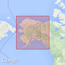
- Alaska Southwestern region
Summary:
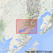
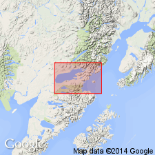
Typically exposed on west shore of Kamishak Bay, especially in vicinity of Bruin Bay, Iliamna region, lower Cook Inlet, southwestern AK. Also exposed at Ursus Cove and northward to Cottonwood Bay. Composed of thin-bedded chert, black calcareous shale and impure limestone, generally black, green or dark red when fresh but weathers to lighter shades. Is complexly crumpled and faulted, cut by small calcite veins, and intruded by quartz diorite. Total thickness is unknown; at Ursus Cove it probably exceeds 2000 ft. Fossil PSEUDOMONOTIS SUBCIRCULARIS (Gabb) from Ursus Cove and HALOBIA cf. SUPERBA Mujsisovics from Bruin Bay (identified by T.W. Stanton) indicate age is Late Triassic.
Source: GNU records (USGS DDS-6; Menlo GNULEX).
- Usage in publication:
-
- Kamishak formation
- Modifications:
-
- Redescribed
- Areal extent
- Biostratigraphic dating
- AAPG geologic province:
-
- Alaska Southwestern region
Summary:
Kamishak chert redescribed as Kamishak formation since unit exposed at Cold Bay is dominantly limestone. Described as thin-bedded, dense, organic limestone interbedded with shale and sandstone, 1400 ft thick. Underlies Bidarka formation (new). Intruded by dikes and sills. Age given as Late Triassic based on PSEUDOMONOTIS SUBCIRCULARIS.
Source: GNU records (USGS DDS-6; Menlo GNULEX).
- Usage in publication:
-
- Kamishak formation*
- Modifications:
-
- Redescribed
- AAPG geologic province:
-
- Alaska Southwestern region
Summary:
Kamishak chert of Martin and Katz (1912) is redescribed as Kamishak formation as suggested by Kellum and Wedow (report in preparation), since section on north shore of Ursus Cove contains only minor amount of chert.
Source: GNU records (USGS DDS-6; Menlo GNULEX).
- Usage in publication:
-
- Kamishak Formation*
- Modifications:
-
- Revised
- AAPG geologic province:
-
- Alaska Southwestern region
Summary:
Unit subdivided into (ascending): Bruin Limestone Member (new), unnamed middle member, and Ursus Member (new). Overlies Cottonwood Bay Greenstone; contact is everywhere covered. Disconformably underlies Talkeetna Formation. Age is considered to be Late Triassic.
Source: GNU records (USGS DDS-6; Menlo GNULEX).
- Usage in publication:
-
- Kamishak Formation*
- Modifications:
-
- Areal extent
- Reference
- AAPG geologic province:
-
- Alaska Peninsula province
- Alaska Southwestern region
Summary:
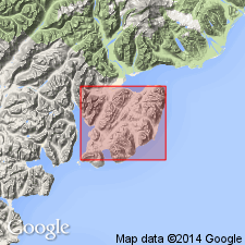
Kamishak Formation. Unit geographically extended into Puale and Alinchak Bays areas. Age is given as Late Triassic in these areas.
Reference section: starts at Cape Kekurnoi, Karluk C-4 and C-5 quadrangles (scale 1:63,360) and continues southwest along the shore for 4.8 km to entrance of Puale Bay, then northwest along shore of Puale Bay, about 600 m to contact with overlying Talkeetna Formation.
Source: Modified from GNU records (USGS DDS-6; Menlo GNULEX).
For more information, please contact Nancy Stamm, Geologic Names Committee Secretary.
Asterisk (*) indicates published by U.S. Geological Survey authors.
"No current usage" (†) implies that a name has been abandoned or has fallen into disuse. Former usage and, if known, replacement name given in parentheses ( ).
Slash (/) indicates name conflicts with nomenclatural guidelines (CSN, 1933; ACSN, 1961, 1970; NACSN, 1983, 2005, 2021). May be explained within brackets ([ ]).