

- Usage in publication:
-
- Kalo Formation
- Modifications:
-
- Named
- Dominant lithology:
-
- Coal
- Shale
- AAPG geologic province:
-
- Iowa shelf
Summary:
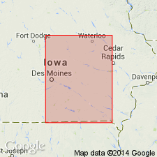
Named for Kalo, southern Webster Co, IA on the Iowa shelf as one of four formations of the Cherokee Group of Des Moines Supergroup. Overlies Kilbourn Formation (named), basal formation of Cherokee Group. Underlies Floris Formation (named) of Cherokee Group. Type section is in SE1/4, NW1/4, SW1/4 sec 17, T88N, R28W. Present over most of southern and central IA on the Iowa shelf in outcrop and in the subsurface. Has two distinctive named members, the Blackoak Coal Member, at base and the Cliffland Coal Member about 60 ft above base of Blackoak. Overlies the newly named Kilbourn Formation, basal formation of Cherokee Group. Underlies the newly named Floris Formation of Cherokee. Stratigraphic chart. Columnar sections. Divided into: 1) Blackoak Coal Member 36.6 ft thick -basal coal, 30.8 ft of interlaminated sandstone, siltstone, and shale in middle, and coal at top; and 2) 19+ ft thick black, hard shale overlain by a thin siltstone at type exposure. In reference subsurface sections, the Cliffland Coal Member 6.3 ft thick is overlain by two sequences of shale grading upwards into siltstone then sandstone. Formation regionally averages 60 ft thick; may be more than 100 ft thick. Kalo deposits produced by deltaic progradation and local swampy conditions. Of Pennsylvanian, Atokan and early Desmoinesian age.
Source: GNU records (USGS DDS-6; Denver GNULEX).
For more information, please contact Nancy Stamm, Geologic Names Committee Secretary.
Asterisk (*) indicates published by U.S. Geological Survey authors.
"No current usage" (†) implies that a name has been abandoned or has fallen into disuse. Former usage and, if known, replacement name given in parentheses ( ).
Slash (/) indicates name conflicts with nomenclatural guidelines (CSN, 1933; ACSN, 1961, 1970; NACSN, 1983, 2005, 2021). May be explained within brackets ([ ]).