

- Usage in publication:
-
- Kainer Formation
- Modifications:
-
- Original reference
- Dominant lithology:
-
- Dolomite
- Sand
- AAPG geologic province:
-
- Gulf Coast basin
Summary:
Pg. 18-19. Kainer Formation of Edwards Group. Chiefly dolomite and lime sand. Thickness 120 m at type section; ranges 120 to 140 m thick. Includes informal dolomitic and grainstone members. Overlies Glen Rose Formation; underlies Person Formation of Edwards Group. Age is Early Cretaceous (Comanchean).
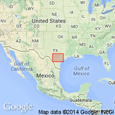
Type section (subsurface): depth-interval 3,290 to 3,410 m, Shell No. 2 Charles Kainer well, Person field, Karnes Co., southeastern TX.
Source: US geologic names lexicon (USGS Bull. 1520, p. 159).
For more information, please contact Nancy Stamm, Geologic Names Committee Secretary.
Asterisk (*) indicates published by U.S. Geological Survey authors.
"No current usage" (†) implies that a name has been abandoned or has fallen into disuse. Former usage and, if known, replacement name given in parentheses ( ).
Slash (/) indicates name conflicts with nomenclatural guidelines (CSN, 1933; ACSN, 1961, 1970; NACSN, 1983, 2005, 2021). May be explained within brackets ([ ]).