The National Geologic Map Database is migrating to a new infrastructure. We apologize for any service disruptions during this process.
|
|---|


- Usage in publication:
-
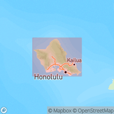
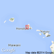
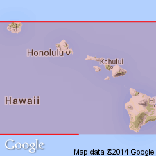
- Kailua volcanic series*
- Modifications:
-
- Named
- Dominant lithology:
-
- Basalt
- AAPG geologic province:
-
- Oahu
Summary:
Named for village of Kailua [Mokapu 7.5' quad] Island of Oahu. Forms low hills surrounding Kailua between Kaneohe and Waimanalo. Composed of amygdaloidal basalt and its feeding dike complex which is best exposed on Mokulua Islands off Lanikai. Flows of pahoehoe and aa are as much as 60 ft thick. In general flows have total thickness of 600 ft and are slightly folded near Lanikai. Underlies Koolau volcanic series. Is deeply weathered and except along coast is almost completely covered with Lantana and soil, both of which make its relation to Koolau series obscure.
Source: GNU records (USGS DDS-6; Menlo GNULEX).
- Usage in publication:
-
- Kailua volcanic series*
- Modifications:
-
- Mapped
- AAPG geologic province:
-
- Oahu
Summary:
Map shows Tertiary and early Pleistocene(?) age. "It is believed that the Kailua volcanic series was formed in and under the caldera of the Koolau Volcano."
Source: GNU records (USGS DDS-6; Menlo GNULEX).
- Usage in publication:
-
- Kailua volcanic series*
- Modifications:
-
- Not used
- AAPG geologic province:
-
- Oahu
Summary:
Unit referred to as "Kailua amygdaloidal basalt" or "Kailua lava". Kailua dike complex may have been laid down within Koolau caldera. "It is now proposed to group these rocks with the Koolau throat breccia and call them all a caldera complex."
Source: GNU records (USGS DDS-6; Menlo GNULEX).
- Usage in publication:
-
- Kailua volcanic series*
- Modifications:
-
- Age modified
- AAPG geologic province:
-
- Oahu
Summary:
These lavas and their feeding dikes are exposed only near Kailua where the beds are 600 ft thick. Stratigraphic chart (p.27) shows Pliocene age, but correlation chart (p.23) shows Pliocene and older age.
Source: GNU records (USGS DDS-6; Menlo GNULEX).
- Usage in publication:
-
- Kailua volcanic series*
- Modifications:
-
- Age modified
- AAPG geologic province:
-
- Oahu
Summary:
Geologic figure map indicates Pliocene(?) age. [no basis given]
Source: GNU records (USGS DDS-6; Menlo GNULEX).

- Usage in publication:
-
- Kailua volcanic series*
- Modifications:
-
- Revised
- AAPG geologic province:
-
- Oahu
Summary:
Total exposed thickness is about 1600 ft but rocks extend below sea level. Included in Koolau volcanic series. Probably separated from adjacent extra-caldera Koolau lavas by faults and buried fault scarps. Formerly regarded as older than Koolau lavas, now believed to be contemporaneous with or even younger than Koolau volcanic series in crest region of Koolau Range. Assigned Pliocene(?) age.
Source: GNU records (USGS DDS-6; Menlo GNULEX).
- Usage in publication:
-
- Kailua Volcanic Series*
- Modifications:
-
- Not used
- AAPG geologic province:
-
- Oahu
Summary:
[Kailua Volcanic Series not mentioned in text but map shows Koolau Volcanic Series where Kailua Volcanic Series should be.]
Source: GNU records (USGS DDS-6; Menlo GNULEX).

- Usage in publication:
-
- Kailua Member*
- Modifications:
-
- Revised
- AAPG geologic province:
-
- Oahu
Summary:
Stearns (1940) recognized that Kailua was part of Koolau Volcano. Kailua Volcanic Series (Stearns, IN Stearns and Vaksvik, 1935) reduced in rank and renamed Kailua Member of Koolau Basalt. No type locality specified. Principal reference locality: Kaiwa Ridge [21 deg 23'08"N, 157 deg 43'22"W] [Kaiwa Ridge not on topo quad but on map in Stearns (1939)] Reference locality: east side of Puu Papaa. Is probably Pleistocene(?) age.
Source: GNU records (USGS DDS-6; Menlo GNULEX).
For more information, please contact Nancy Stamm, Geologic Names Committee Secretary.
Asterisk (*) indicates published by U.S. Geological Survey authors.
"No current usage" (†) implies that a name has been abandoned or has fallen into disuse. Former usage and, if known, replacement name given in parentheses ( ).
Slash (/) indicates name conflicts with nomenclatural guidelines (CSN, 1933; ACSN, 1961, 1970; NACSN, 1983, 2005, 2021). May be explained within brackets ([ ]).