

- Usage in publication:
-
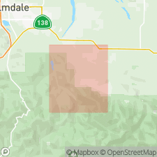
- Juniper Hills Formation
- Modifications:
-
- Named
- Dominant lithology:
-
- Sandstone
- Conglomerate
- Siltstone
- Shale
- Breccia
- AAPG geologic province:
-
- Transverse Ranges province
Summary:
Juniper Hills Formation is named for deposits in Juniper Hills area about 20 km southeast of Palmdale; area straddles the San Andreas fault zone in this region. Crops out in three structurally separated groups of members, group "A" lies between San Andreas and Northern Nadeau faults; group "B" is exposed in Juniper Bowl syncline between Northern Nadeau and Southern Nadeau-Holmes fault; group "C" is exposed east and west of Cima Mesa south of Punchbowl fault. Rocks of Juniper Hills Formation in Palmdale quad were mapped by Noble (1953) as Punchbowl Formation. Unit consists of interstratified and interfingering fluvial, alluvial fan, lacustrine and or playa deposits that include sandstone, pebbly sandstone, conglomerate, siltstone, gypsiferous clay shale, and coarse sedimentary breccia. Overlies Punchbowl Formation. Is in fault contact with underlying[?] Ritter Formation of Pliocene(?) and/or Pleistocene(?) age. Underlies[?] Harold Formation of Pleistocene age. Poorly preserved pollen from clay shale member was analyzed by John L. Browning (written commun., 1975) to be of early Pliocene age. Age of unit given as Pliocene or Pleistocene.
Source: GNU records (USGS DDS-6; Menlo GNULEX).
For more information, please contact Nancy Stamm, Geologic Names Committee Secretary.
Asterisk (*) indicates published by U.S. Geological Survey authors.
"No current usage" (†) implies that a name has been abandoned or has fallen into disuse. Former usage and, if known, replacement name given in parentheses ( ).
Slash (/) indicates name conflicts with nomenclatural guidelines (CSN, 1933; ACSN, 1961, 1970; NACSN, 1983, 2005, 2021). May be explained within brackets ([ ]).