

- Usage in publication:
-
- Jumbo dolomite member*
- Modifications:
-
- Named
- Dominant lithology:
-
- Dolomite
- AAPG geologic province:
-
- Piedmont-Blue Ridge province
Summary:
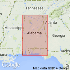
Named Jumbo dolomite member of the Talladega slate for exposures and quarries at and near Jumbo, Chilton Co., AL. The unit apparently lies several thousand feet above the ferruginous sandstone member of the Talladega, and several thousand feet below top of the Talladega, being both underlain and overlain by ordinary phyllite of Talladega type. In a least one place this member consists of an upper dolomite bed 60 feet thick and a lower dolomite bed 20 feet thick, the two separated by a 40 foot bed of phyllite. Thickness is at least 120 feet. Unit extends from NE 1/4 sec. 4, T. 23 N, R. 16 E, south and west to half a mile west of old Jumbo post office. The Jumbo is probably of Paleozoic age.
Source: GNU records (USGS DDS-6; Reston GNULEX).
- Usage in publication:
-
- Jumbo Dolomite*
- Modifications:
-
- Age modified
- Biostratigraphic dating
Summary:
The basal carbonate unit of the Sylacauga Marble Group of Tull (1982), the Jumbo Dolomite, as used by Tull (1982), contains archaeocyathids which are not found above the Lower Cambrian in North America (Alison Palmer, personal communication). The age of the Jumbo is Early Cambrian, which confirms its correlation with the Shady Dolomite.
Source: GNU records (USGS DDS-6; Reston GNULEX).
For more information, please contact Nancy Stamm, Geologic Names Committee Secretary.
Asterisk (*) indicates published by U.S. Geological Survey authors.
"No current usage" (†) implies that a name has been abandoned or has fallen into disuse. Former usage and, if known, replacement name given in parentheses ( ).
Slash (/) indicates name conflicts with nomenclatural guidelines (CSN, 1933; ACSN, 1961, 1970; NACSN, 1983, 2005, 2021). May be explained within brackets ([ ]).