The National Geologic Map Database is migrating to a new infrastructure. We apologize for any service disruptions during this process.
|
|---|


- Usage in publication:
-
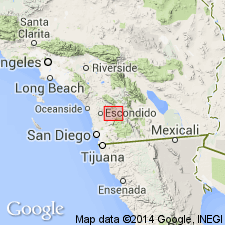
- Julian group
- Modifications:
-
- Named
- Dominant lithology:
-
- Schist
- AAPG geologic province:
-
- Peninsular Ranges province
Summary:
Named for exposures near town of Julian, San Diego Co. and Imperial Co., CA. [no type section designated] Consists of mica schists, slates, quartzites, and limestone. Regarded as possibly lithologically and structurally equivalent to the Calaveras Group. Assigned Carboniferous(?) or older age
Source: GNU records (USGS DDS-6; Menlo GNULEX).
- Usage in publication:
-
- Julian schist
- Modifications:
-
- Age modified
- Revised
- AAPG geologic province:
-
- Peninsular Ranges province
Summary:
Formerly designated "Julian group" (Merrill, 1914), now called Julian schist or Julian schist series. Mapped in Cuyamaca region. Consists of quartz-mica schists, amphibolite schists, paragneiss, and quartzite. Is more than 6,600 feet. thick. Intruded by Stonewall quartz diorite. Is Triassic(?) age indicated by ammonite float specimen (Smith, oral communication).
Source: GNU records (USGS DDS-6; Menlo GNULEX).

- Usage in publication:
-
- Julian schist
- Modifications:
-
- Age modified
- AAPG geologic province:
-
- Peninsular Ranges province
Summary:
Assigned to Jurassic-Triassic(?) age based on lithologic and structural correlation with Calaveras formation (mainly Carboniferous) and with Santa Ana slates (Late Triassic) of the Santa Ana Mountains.
Source: GNU records (USGS DDS-6; Menlo GNULEX).
- Usage in publication:
-
- Julian schist
- Modifications:
-
- Areal extent
- AAPG geologic province:
-
- Peninsular Ranges province
Summary:
Pg. 120-121. Julian schist of southern Peninsular Range [San Diego County, southern California] is same as Julian group of Merrill and Julian schist of Hudson. No fossils found. May include rocks of Triassic, late Paleozoic, or even older ages. Evidence obtained strongly suggests it is largely or wholly metamorphosed Triassic sediments.
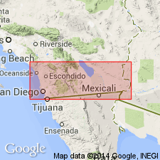
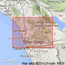
Extended geographically and mapped in area across Peninsular Range near highway for 70 mi. from La Mesa to Coyote Wells.
Source: US geologic names lexicon (USGS Bull. 896, p. 1058); supplemental information from GNU records (USGS DDS-6; Menlo GNULEX).

- Usage in publication:
-
- Julian schist
- Modifications:
-
- Mapped
- AAPG geologic province:
-
- Peninsular Ranges province
Summary:
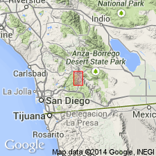
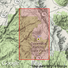
Mapped in Julian-Cuyamaca area, San Diego Co., CA at scale 1" to 2000 feet.
Source: GNU records (USGS DDS-6; Menlo GNULEX).
- Usage in publication:
-
- Julian schist
- Modifications:
-
- Areal extent
- AAPG geologic province:
-
- Peninsular Ranges province
Summary:
Extended into and mapped in southwest part of Ramona 30' quad., San Diego Co., CA. Assigned Triassic(?) age. [no basis given]
Source: GNU records (USGS DDS-6; Menlo GNULEX).
- Usage in publication:
-
- Julian schist*
- Modifications:
-
- Mapped
- AAPG geologic province:
-
- Peninsular Ranges province
Summary:
Mapped in Cuyamaca Peak 15' quad., San Diego Co., CA. Map also includes Julian Schist and Stonewall Granodiorite undivided.
Source: GNU records (USGS DDS-6; Menlo GNULEX).
- Usage in publication:
-
- Julian schist*
- Modifications:
-
- Mapped
- AAPG geologic province:
-
- Peninsular Ranges province
Summary:
Mapped in Santa Ysabel 15-min quadrangle, San Diego County, California.
Source: GNU records (USGS DDS-6; Menlo GNULEX).
- Usage in publication:
-
- Julian schist*
- Modifications:
-
- Areal extent
- AAPG geologic province:
-
- Peninsular Ranges province
Summary:
Certain rocks in western San Diego Co., previously ascribed to "Julian Schist" are actually Alisitos Formation.
Source: GNU records (USGS DDS-6; Menlo GNULEX).
- Usage in publication:
-
- Julian schist*
- Modifications:
-
- Mapped
- AAPG geologic province:
-
- Peninsular Ranges province
Summary:
Julian Schist and Bedford Canyon Formation are mapped "undivided" but map states Julian Schist is in northeast, central and southeast parts of San Diego Co.
Source: GNU records (USGS DDS-6; Menlo GNULEX).
- Usage in publication:
-
- Julian Schist*
- Modifications:
-
- Age modified
- AAPG geologic province:
-
- Peninsular Ranges province
Summary:
Assigned Cretaceous age in columnar section. [no basis given]
Source: GNU records (USGS DDS-6; Menlo GNULEX).
- Usage in publication:
-
- Julian Schist*
- Modifications:
-
- Areal extent
- AAPG geologic province:
-
- Peninsular Ranges province
Summary:
Quartzite-phyllite sequence at the south end of Sierra San Pedro Martir, State of Baja California, Mexico resembles the Julian Schist of San Diego Co., CA. Discontinuously exposed rocks extend southeastward. Suggests Triassic(?) and Jurassic(?) age based on analogy to areas north of border.
Source: GNU records (USGS DDS-6; Menlo GNULEX).
- Usage in publication:
-
- Julian Schist*
- Modifications:
-
- Areal extent
- AAPG geologic province:
-
- Peninsular Ranges province
Summary:
"Julian Schist-like rocks are distributed along the length of the Peninsular Ranges, lying between the Santiago Peak and Alisitos volcanic rocks to the west and the undated (Triassic?) carbonate-rich sequences of the eastern escarpment."
Source: GNU records (USGS DDS-6; Menlo GNULEX).

- Usage in publication:
-
- Julian Schist*
- Modifications:
-
- Mapped
- AAPG geologic province:
-
- Peninsular Ranges province
Summary:
Consists primarily of quartz-cordierite-biotite schist and quartz-diopside gneiss. Exposed throughout batholith. Sketch mapped in Corte Madera pluton. Although distribution overlaps that of Santiago Peak Volcanics no evidence is observed for structural relationship. Is no younger than Triassic(?) based on stratigraphic relations.
Source: GNU records (USGS DDS-6; Menlo GNULEX).
For more information, please contact Nancy Stamm, Geologic Names Committee Secretary.
Asterisk (*) indicates published by U.S. Geological Survey authors.
"No current usage" (†) implies that a name has been abandoned or has fallen into disuse. Former usage and, if known, replacement name given in parentheses ( ).
Slash (/) indicates name conflicts with nomenclatural guidelines (CSN, 1933; ACSN, 1961, 1970; NACSN, 1983, 2005, 2021). May be explained within brackets ([ ]).