The National Geologic Map Database is migrating to a new infrastructure. We apologize for any service disruptions during this process.
|
|---|


- Usage in publication:
-
- Juana Lopez sandstone member
- Modifications:
-
- Named
- Dominant lithology:
-
- Sandstone
- AAPG geologic province:
-
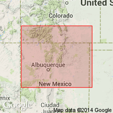
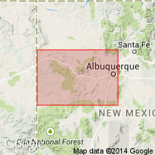
- Estancia basin
Summary:
Named as a member near the top of the Carlile shale of the Colorado group for Mesita Juana Lopez Grant west of Cerillos, Santa Fe Co, NM in the Estancia basin. Type section designated at and measured in sec 32, T15N, R7E on the Grant, 6 miles northwest of Cerillos. Is composed of very calcareous, thin-bedded, brown-weathering, fossiliferous sandstone 10 ft thick at type. Fossils include PRINOCYCLUS WYOMINGENSIS Meek and INOCERAMUS LABIATUS SCHLOTHEIM. Overlies and underlies unnamed black shale of the Carlile. Lies 314 ft above base of Carlile at type. Is a widespread unit throughout northern NM and western CO. Has a Frontier fauna. Is older than the Codell sandstone [member] of the Carlile in the Arkansas Valley area of CO. Late Cretaceous age assigned. Cross sections.
Source: GNU records (USGS DDS-6; Denver GNULEX).
- Usage in publication:
-
- Juana Lopez Member*
- Modifications:
-
- Overview
- AAPG geologic province:
-
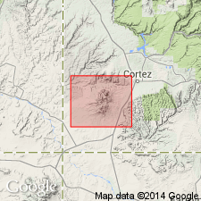
- Paradox basin
Summary:
Is a member of the Upper Cretaceous Mancos Shale above and below unnamed parts of the Mancos in Montezuma Co, CO in the Paradox basin. Identified as a 42 ft thick gray, finely crystalline, very fossiliferous (pelecypods--INOCERAMUS PERPLEXUS Whitfield and OSTREA LUGUBRIS Conrad, and a skate tooth PTYCHODUS WHIPPLEI Marcou) and dark-gray fissile mudstone in a measured section. Six ft above base a fine-grained limy sandstone lens 6 inches thick that contains frosted quartz, abundant black accessory minerals, and argillaceous material recognized. Base and top placed at base of and top of a limestone bed. At localities in the Ute Mountains a few inches to 9 ft thick gray, glauconitic, cross-stratified, coarse-grained sandstone used as the top bed. Ranges from less than 25 to more than 100 ft thick in report area. Lies 475 ft above base of Mancos. Geologic map. Stratigraphic chart.
Source: GNU records (USGS DDS-6; Denver GNULEX).
- Usage in publication:
-
- Juana Lopez Member*
- Modifications:
-
- Reference
- Dominant lithology:
-
- Limestone
- Shale
- Bentonite
- AAPG geologic province:
-
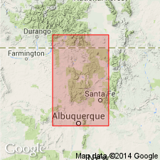
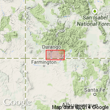
- San Juan basin
Summary:
Is a member of Mancos Shale in northwest NM. Reference section designated at SE1/4 SW1/4 sec 14, T19N, R1W, La Ventana quad, Sandoval Co, NM, San Juan basin. Consists of dark-gray to black shale that may contain septarian limestone concretions, hard, calcareous, locally cross-bedded siltstone, and hard, very fine- to fine-grained silty thin-bedded calcarenite that may be fossiliferous, very finely granular limestone, nearly 107 ft thick at reference section. Has limestone and siderite concretions in upper part. Bentonite beds several inches thick occur locally. Ranges from 90-135 ft thick on east and southeast side of basin. Is fossiliferous (ammonites and pelecypods). Is of early late Turonian, Late Cretaceous age. In contrast, at type section NW1/4 SE1/4 sec 33, T15N, R7E, Madrid quad, Santa Fe Co, NM, Estancia basin, is only 3 ft 10 in thick and composed of dark-gray, brown to rusty weathering, fine- to medium-grained, granular fossiliferous calcarenite that grades into bioclastic, medium-gray, fine-grained limestone, and minor soft, granular siltstone. Overlies and underlies unnamed parts of Mancos. Measured sections. Is one of the most persistent And distinctive units of Mancos. Is a member of Carlile Shale in central and southeast CO and northeast NM.
Source: GNU records (USGS DDS-6; Denver GNULEX).
- Usage in publication:
-
- Juana Lopez Member*
- Modifications:
-
- Mapped 1:24k (Jefferson Co, CO)
- Dominant lithology:
-
- Calcarenite
- AAPG geologic province:
-
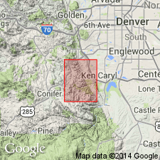
- Denver basin
Summary:
Juana Lopez included within and as the upper member of the Carlile Shale (mapped) of Late Cretaceous age in this report in the Denver basin area. The member is described as a yellow-gray calcarenite 1 to 2 ft thick that lies above the Blue Hill Shale Member of the Carlile and below the Fort Hays Limestone Member of the Niobrara Formation.
Source: GNU records (USGS DDS-6; Denver GNULEX).
- Usage in publication:
-
- Juana Lopez Member*
- Modifications:
-
- Areal extent
- AAPG geologic province:
-
- Las Vegas-Raton basin
Summary:
Is one of four members of Carlile Formation. Extended areally to Gold Creek exposure in sec 4, T31N, R17E, Colfax Co, NM in the Las Vegas-Raton basin. Is 25 ft thick in measured section, where it overlies upper unit of Blue Hill Shale Member of Carlile and underlies upper black shale unit of Carlile. Composed of a local unit of fine-grained calcarenite of shell and limestone fragments and shale interbedded with a basal coquina of pelecypod fragments and an upper part of black, calcareous shale with layers of very fine grained to fine-grained calcarenite. Of Cretaceous age.
Source: GNU records (USGS DDS-6; Denver GNULEX).
- Usage in publication:
-
- Juana Lopez Member*
- Modifications:
-
- Overview
- Dominant lithology:
-
- Shale
- Sandstone
- AAPG geologic province:
-
- Estancia basin
Summary:
Assigned to the Mancos Shale in this report. Rankin (1944) incorrectly located the type section of the Juana Lopez in sec 32, where no Juana Lopez is present. Also Rankin's definition of Juana Lopez included only 10 ft of calcarenite. Bozanic's (1955) definition to include 96 more ft of rock beneath the 10 ft calcarenite has been followed by most workers since 1955. The type section is moved to sec 33 in T15N, R7E, Santa Fe Co, NM in the Estancia basin where the member is 106 ft thick and is composed of dark-gray noncalcareous shale interbedded with calcarenite. Section measured. Overlies and underlies unnamed parts of the Mancos Shale. Contains middle Turonian mollusks.
Source: GNU records (USGS DDS-6; Denver GNULEX).
- Usage in publication:
-
- Juana Lopez Member*
- Modifications:
-
- Areal extent
- Revised
- AAPG geologic province:
-
- North Park basin
Summary:
Upper Cretaceous Juana Lopez Member identified and assigned as the upper member of the Benton Shale. Is well exposed between Diamond Peak and Stevens Creek in Jackson Co, CO in the North Park basin. Overlies Graneros Shale Member of Benton. Underlies Niobrara Formation. Consists of a petroliferous calcareous coquina and fine-grained shaly sandstone with abundant INOCERAMUS shells. Has a shale-pebble-shark-and-ray-tooth conglomerate locally at base.
Source: GNU records (USGS DDS-6; Denver GNULEX).
- Usage in publication:
-
- Juana Lopez Member
- Modifications:
-
- Overview
- AAPG geologic province:
-
- Denver basin
- Las Vegas-Raton basin
Summary:
Study area extends from Colorado Springs in El Paso Co, CO in the Denver basin south to Walsenburg in Huerfano Co, CO in the Las Vegas-Raton basin. As a member of Carlile Shale, Juana Lopez disconformably overlies Codell Sandstone Member of Carlile. Juana Lopez is usually less than 1 m thick in study area; it thickens south into NM and its northern limit is probably near Boulder, CO. Juana Lopez consists mostly of dark fetid bioclastic limestone; it has a basal lag deposit of reworked sandstone from the underlying Codell mixed with shark teeth, bones, and broken mollusk shells. Juana Lopez represents the basal transgressive deposit of the Niobrara cyclothem laid down in late Turonian time. Underlies Fort Hays Limestone Member of Niobrara Chalk.
Source: GNU records (USGS DDS-6; Denver GNULEX).
- Usage in publication:
-
- Juana Lopez Member*
- Modifications:
-
- Biostratigraphic dating
- Overview
- AAPG geologic province:
-
- San Juan basin
Summary:
Is member of the Mancos Shale in the San Juan basin in west-central NM. Overlies unnamed shale member of the Mancos in Gallup and Laguna-San Ysidro areas. Overlain by younger unnamed shale member of Mancos in same areas. Molluscan fossils are abundant at the reference section locality of Dane and others (1966) about 12 km north of the field conference area. Is of late Turonian age at reference locality; spanning the ammonite zones of PRIONOCYCLUS MACOMBI, P. WYOMINGENSIS, and SCAPHITES WHITFIELDI. Extends southward to near Gallup and southeastward through the Grants-Laguna area. Fossils are scarce and poorly preserved in Gallup area, where unit is only assigned to ammonite zone of P. MACOMBI of early late Turonian age. Figure 2 is stratigraphic nomenclature and correlation chart of middle Cenomanian to lower Coniacian rocks in west-central NM, spanning 20 ammonite zones.
Source: GNU records (USGS DDS-6; Denver GNULEX).
- Usage in publication:
-
- Juana Lopez Member*
- Modifications:
-
- Areal extent
- AAPG geologic province:
-
- San Juan basin
Summary:
Mapped as a member of the Upper Cretaceous Mancos Shale on five cross sections of the subsurface of southern La Plata Co, CO and northern San Juan Co, NM in the San Juan basin. Overlies an unnamed part of Mancos. Upper contact with an upper unnamed part of Mancos shown as a questionable unconformity--sometimes known as the basal Niobrara unconformity. Is about 100 ft thick.
Source: GNU records (USGS DDS-6; Denver GNULEX).
- Usage in publication:
-
- Juana Lopez Member*
- Modifications:
-
- Areal extent
- Overview
- AAPG geologic province:
-
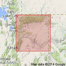
- Uinta basin
Summary:
As a member of Mancos Shale, is 80-100 ft thick on south side of Uinta basin, UT. Overlies Ferron Sandstone Member south of Farnham dome, Carbon Co. Basal contact is sharp. Grades into main body of Mancos on west side of dome. Nomenclature change from Juana Lopez Member of Mancos Shale to upper part, Frontier Formation of Mancos Group takes place at west side of Douglas Creek arch in CO. Has been misidentified as Ferron Sandstone Member of Mancos on some maps. Consists of a lower dark-gray or black noncalcareous fissile clay shale and noncalcareous clay shale and ripple-bedded calcareous coarse siltstone or very fine grained sandstone. Has a few thin beds of bentonite. Weathers to rubble covered hills. Thin calcarenite beds present resulted from fragmentation of mollusk shells by fish (rays and sharks). Is equivalent to part of the Frontier Formation on the north side of the Uinta basin. Very fossiliferous. Of late Turonian age. Stratigraphic chart. Cross sections.
Source: GNU records (USGS DDS-6; Denver GNULEX).
For more information, please contact Nancy Stamm, Geologic Names Committee Secretary.
Asterisk (*) indicates published by U.S. Geological Survey authors.
"No current usage" (†) implies that a name has been abandoned or has fallen into disuse. Former usage and, if known, replacement name given in parentheses ( ).
Slash (/) indicates name conflicts with nomenclatural guidelines (CSN, 1933; ACSN, 1961, 1970; NACSN, 1983, 2005, 2021). May be explained within brackets ([ ]).