The National Geologic Map Database is migrating to a new infrastructure. We apologize for any service disruptions during this process.
|
|---|


- Usage in publication:
-
- Joyita member
- Modifications:
-
- Original reference
- Dominant lithology:
-
- Sandstone
- AAPG geologic province:
-
- Orogrande basin
- Permian basin
Summary:
Pg. 1660. Joyita member of Yeso formation of Manzano group. Name applied to soft cross-bedded sandstone that forms uppermost unit of formation. In Joyita Hills, 160 feet thick and consists of pink, orange, and yellow thin-bedded sandstone that weathers to rounded ledges; orange color and manner of weathering distinguish member. Thickness 185 feet at Yeso type section; 120 feet at Chupadera Mesa; 105 feet at Bend. Overlies limestones of middle evaporites or Canas gypsum member (new); underlies Glorieta sandstone. [Age is Early Permian (Leonard).]
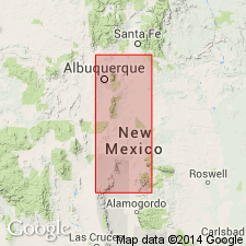
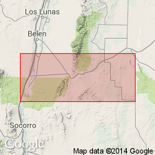
Named from section in canyon of west-flowing tributary of Rio Grande in La Joyita Hills, 18 mi north of Socorro and about 4.5 mi south of village of La Joya, Socorro Co., central NM. [Also exposed in Chaves and Otero Cos.]
Source: US geologic names lexicon (USGS Bull. 1200, p. 1943-1944, Yeso entry p. 4325).
- Usage in publication:
-
- Joyita member*
- Modifications:
-
- Revised
- AAPG geologic province:
-
- Estancia basin
- Orogrande basin
Summary:
A new member, Torres member, named. Yeso formation divisible into two mapped units: 1) the Meseta Blanca sandstone member at the base; and 2) the overlying undifferentiated Torres, Canas, and Joyita members. Meseta Blanca overlies Abo formation. Joyita, the uppermost member, underlies Glorieta sandstone member, basal member of San Andres formation. Yeso mapped at southwest and south-central to northeast part of area in Socorro Co (Orogrande basin) and in Torrance Co (Estancia basin). Cross sections. Of Leonard, Early Permian age.
Source: GNU records (USGS DDS-6; Denver GNULEX).
For more information, please contact Nancy Stamm, Geologic Names Committee Secretary.
Asterisk (*) indicates published by U.S. Geological Survey authors.
"No current usage" (†) implies that a name has been abandoned or has fallen into disuse. Former usage and, if known, replacement name given in parentheses ( ).
Slash (/) indicates name conflicts with nomenclatural guidelines (CSN, 1933; ACSN, 1961, 1970; NACSN, 1983, 2005, 2021). May be explained within brackets ([ ]).