

- Usage in publication:
-
- Joss sand
- Modifications:
-
- Named
- Dominant lithology:
-
- Sandstone
- Limestone
- Dolomite
- AAPG geologic province:
-
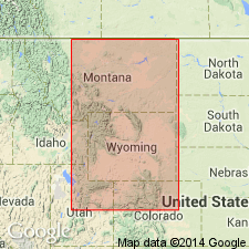
- Powder River basin
Summary:
Informal term, named for a sandstone in the Minnelusa formation in the Lance Creek oil field, Niobrara Co, WY in the Powder River basin. The Minnelusa Oil Corp., in deepening its Joss No. 2 well, SE1/4 NE1/4 SW1/4 sec 6, T35N, R65W, found an oil-producing zone at a depth of 5,260-5,307 ft. This new oil-producing zone is generally called the "Joss sand" or "second bench of the Leo sand." Consists of porous dolomite, limestone, sandy limestone, sandy dolomite, and thin sandstone extending as much as 200 ft below the Leo sand. Pennsylvanian in age.
Source: GNU records (USGS DDS-6; Denver GNULEX).
- Usage in publication:
-
- Joss sand
- Modifications:
-
- Areal extent
- Overview
- AAPG geologic province:
-
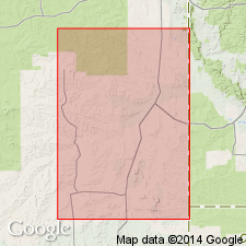
- Powder River basin
Summary:
Gives thickness and shows stratigraphic position within the middle part of the Minnelusa formation in representative sections in the Dewey Dome oil field, Weston Co, WY, and in the Mule Creek and Lance Creek oil fields, Niobrara Co, WY in the Powder River basin. Shown as sandstone, 25 ft thick, and 155 ft below the Leo sand, in the representative well, Lance Creek field. Pennsylvanian in age.
Source: GNU records (USGS DDS-6; Denver GNULEX).
For more information, please contact Nancy Stamm, Geologic Names Committee Secretary.
Asterisk (*) indicates published by U.S. Geological Survey authors.
"No current usage" (†) implies that a name has been abandoned or has fallen into disuse. Former usage and, if known, replacement name given in parentheses ( ).
Slash (/) indicates name conflicts with nomenclatural guidelines (CSN, 1933; ACSN, 1961, 1970; NACSN, 1983, 2005, 2021). May be explained within brackets ([ ]).