The National Geologic Map Database is migrating to a new infrastructure. We apologize for any service disruptions during this process.
|
|---|


- Usage in publication:
-
- Jose Creek member
- Modifications:
-
- Named
- Dominant lithology:
-
- Shale
- Sandstone
- Chert
- Conglomerate
- AAPG geologic province:
-
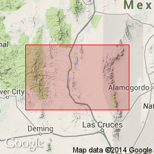
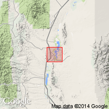
- Orogrande basin
Summary:
Named as basal member of McRae formation for Jose Creek which enters Elephant Butte Reservoir just east of Elephant Butte, Sierra County, New Mexico (Orogrande basin). Type locality lies immediately east of Elephant Butte Reservoir, north of McRae Canyon. Unconformably overlies Mesaverde formation. Conformably underlies Hall Lake member (new) of McRae formation. Lower contact represents deposition on an erosional, slightly undulating surface. Is 394 feet thick at its type where it consists of olive-drab shale, dark-brown to greenish andesitic sandstone and bedded chert. Has coarse volcanic conglomerate beds near Elephant Butte dam. Is present near the reservoir, in McRae Canyon, and at south end of Fra Cristobal Mountains. Outcrops are discontinuous. To southeast of McRae Canyon, Jose Creek is missing, and Hall Lake rests on Mesaverde. Conglomerate contains pebbles and cobbles of intermediate volcanics and basalt porphyry. Has some boulders 6 feet in diameter. Not easily distinguished from Mesaverde where Mesaverde and the Jose Creek include green shale and brown sandstone. The key to recognition are the presence of andesitic and volcanic material in Jose Creek. Florule and presence of TRICERATOPS indicates Late Cretaceous age. Cross section, stratigraphic chart.
Source: GNU records (USGS DDS-6; Denver GNULEX).
- Usage in publication:
-
- Jose Creek Member
- Modifications:
-
- Overview
- AAPG geologic province:
-
- Orogrande basin
Summary:
Unconformably overlies Ash Canyon Member of Mesaverde Formation. Mapped (geologic map) as the basal member of the McRae Formation in eastern part of area, Sierra Co, NM in the Orogrande basin. Consists of 120 m of: 1) breccia conglomerate of cobble- to boulder-size clasts of basalt, latite, and Mesaverde sandstone whose matrix is green to gray, fine to medium grained with angular crystal and lithic fragments; 2) conglomerate of subangular to subround porphyritic basalt to latite cobbles and pebbles in a sandy andesitic matrix, brown and green sandstone interbedded with olive to purple shale, siltstone, and conglomerate. Forms low hills or ridges. Conformably underlies Hall Lake Member, upper member of McRae. Of Cretaceous age. Many fossil plants (listed); ceratopsian dinosaur remains.
Source: GNU records (USGS DDS-6; Denver GNULEX).
For more information, please contact Nancy Stamm, Geologic Names Committee Secretary.
Asterisk (*) indicates published by U.S. Geological Survey authors.
"No current usage" (†) implies that a name has been abandoned or has fallen into disuse. Former usage and, if known, replacement name given in parentheses ( ).
Slash (/) indicates name conflicts with nomenclatural guidelines (CSN, 1933; ACSN, 1961, 1970; NACSN, 1983, 2005, 2021). May be explained within brackets ([ ]).