The National Geologic Map Database is migrating to a new infrastructure. We apologize for any service disruptions during this process.
|
|---|


- Usage in publication:
-
- Jordan sandstone
- Modifications:
-
- Named
- Dominant lithology:
-
- Sandstone
- AAPG geologic province:
-
- Sioux uplift
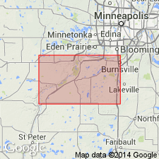
Summary:
A sandrock formation, exposed in beer vaults at Jordan and along Sand Creek, referred to as Jordan sandstone. Consists of (descending): (F) sandrock, buffish, quite ferruginous, thick-bedded, seen at mill 6 ft; (E) sandrock, ferruginous, thin and irregularly bedded, friable and disintegrating, with many ferruginous seams, crusts, and concretions, in the quarry 3 ft; (D) sandrock, irregularly whitish or ferruginous, heavy-bedded, obliquely and beautifully banded with iron streaks and laminae, in quarry 12 ft; (C) sandrock, buffish, similar to D, but thinner bedded, in quarry 8 ft; (B) sandrock, hard and ferruginous above, soft, friable, and buffish red below, Falls of Sand Creek 10 ft; and (A) sandrock, whitish, compact, in the beer vaults 12 ft. Underlies Lower Magnesian limestone of Owen. Occurs at considerable elevation above the magnesian limestone at St. Lawrence. [Though in two places called Jordan sandstone, author at another states that he regards this as Potsdam sandstone.]
Source: GNU records (USGS DDS-6; Reston GNULEX).
- Usage in publication:
-
- Jordan sandstone
- Modifications:
-
- Overview
- Dominant lithology:
-
- Conglomerate
- Sandstone
- AAPG geologic province:
-
- Sioux uplift
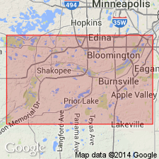
Summary:
Type section or locality along Sand Creek near the town of Jordan, Scott Co, MN on the Sioux uplift, measured by Winchell is remeasured and redescribed. Winchell's section was 51+ ft thick. The redescribed section (a composite section) is 94 ft thick and is divided into: 1) basal conglomerate of flat gray dolomite pebbles in a pink sandy dolomitic matrix 3 ft thick and 2) an overlying sandstone that varies from medium to coarse grained, thin-bedded to massive, friable, white, yellow, gray to brown 91 ft thick. Is uniform in thickness (80-100 ft) [in MN?]. To south in IA thickness is irregular, locally not more than 30 ft thick. Has linguloid brachiopod fossils. Overlies St. Lawrence formation. Late Cambrian, St. Croixan age inferred.
Source: GNU records (USGS DDS-6; Denver GNULEX).
- Usage in publication:
-
- Jordan Formation
- Modifications:
-
- Revised
- Overview
- AAPG geologic province:
-
- Wisconsin arch
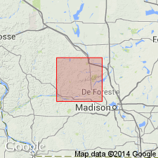
Summary:
Jordan Formation [in WI] is now generally considered to have two major subdivisions: the lower Norwalk and the upper Van Oser Members. The Sunset Point Member is present near the top of the Jordan in Dane Co., but has not been identified in the area of this report (Sauk Co.). The Coon Valley, considered here a member of the overlying Oneota Formation, was assigned to the Jordan by Odom and Ostrom (1978). The two members are distinguished by grain size. The Norwalk contains fine quartz sand, with some very fine and medium sand, and the Van Oser contains medium sand, with some fine and coarse sand. Norwalk also contains considerable feldspar. Members are mapped together is this report and total about 20 m. Scattered throughout the quartzose sandstone are thin beds of greenish-gray shale. The Jordan is, for the most part, nonglauconitic, noncalcareous, and nondolomitic; planar and cross-bedded, locally bioturbated, and so interpreted as marine. Contact with underlying Lodi Member of St. Lawrence is abrupt. Age of the Jordan shown in stratigraphic column as Late Cambrian and Early Ordovician.
Source: GNU records (USGS DDS-6; Reston GNULEX).
- Usage in publication:
-
- Jordan Sandstone
- Modifications:
-
- Age modified
- AAPG geologic province:
-
- Upper Mississippi embayment
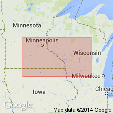
Summary:
Late Cambrian (Croixan) Jordan Sandstone is here restricted from Early Ordovician age and evidence shows it is entirely marine and regressive, rather than transgressive as commonly assumed. Base of the Jordan is conformable with underlying Late Cambrian St. Lawrence Formation, but contact between Cambrian and Ordovician rocks in the Hollandale embayment is here interpreted as an unconformity between the regressive Jordan below and transgressive Early Ordovician Oneota Dolomite above. Evidence includes (1) sharp, undulatory contact between the Jordan and Coon Valley Member of the Oneota in most outcrops, (2) poorly sorted, locally reworked, intraclastic lag containing Precambrian pebbles at base of the Coon Valley, and (3) deep truncation of the Jordan near margins of the Hollandale embayment in south-central WI and along the Minnesota River Valley. The fact that the unconformity is regional has important implications for boundary placement in entire Upper Mississippi Valley. According to author members of the Jordan were never adequately defined in accordance with the North American Stratigraphic Code and consequently were not useful to this study. Report includes measured sections and cross section.
Source: GNU records (USGS DDS-6; Reston GNULEX).
For more information, please contact Nancy Stamm, Geologic Names Committee Secretary.
Asterisk (*) indicates published by U.S. Geological Survey authors.
"No current usage" (†) implies that a name has been abandoned or has fallen into disuse. Former usage and, if known, replacement name given in parentheses ( ).
Slash (/) indicates name conflicts with nomenclatural guidelines (CSN, 1933; ACSN, 1961, 1970; NACSN, 1983, 2005, 2021). May be explained within brackets ([ ]).