The National Geologic Map Database is migrating to a new infrastructure. We apologize for any service disruptions during this process.
|
|---|


- Usage in publication:
-
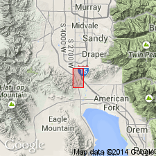
- Jordan Narrows unit
- Modifications:
-
- First used
- Dominant lithology:
-
- Marlstone
- Limestone
- Sandstone
- Clay
- Tuff
- AAPG geologic province:
-
- Wasatch uplift
Summary:
First used as an informal unit in the Salt Lake group for exposures in Jordan Narrows, Salt Lake Co, UT on the Wasatch uplift. These exposures called the type locality. Intertongues with the underlying Traverse volcanics (first published use). Unconformably underlies the Camp Williams unit, new informal unit, of the Salt Lake group. Composed of white marlstone, oolitic, argillaceous, and cherty limestone, sandstone, clay, and rhyolitic tuff. Total thickness unknown. Probably exceeds 300 ft thick. May be as much as 2,000 ft thick. Geologic map. Areal extent not known. May be present in entire Jordan Valley. Ostracods indicate Miocene-Pliocene age. Lithologically similar to Norwood tuff. Assigned to the early and middle Miocene.
Source: GNU records (USGS DDS-6; Denver GNULEX).
For more information, please contact Nancy Stamm, Geologic Names Committee Secretary.
Asterisk (*) indicates published by U.S. Geological Survey authors.
"No current usage" (†) implies that a name has been abandoned or has fallen into disuse. Former usage and, if known, replacement name given in parentheses ( ).
Slash (/) indicates name conflicts with nomenclatural guidelines (CSN, 1933; ACSN, 1961, 1970; NACSN, 1983, 2005, 2021). May be explained within brackets ([ ]).