The National Geologic Map Database is migrating to a new infrastructure. We apologize for any service disruptions during this process.
|
|---|


- Usage in publication:
-
- Joplin Member*
- Modifications:
-
- Named
- Dominant lithology:
-
- Limestone
- Chert
- AAPG geologic province:
-
- Chautauqua platform
- Cherokee basin
- Ozark uplift
Summary:
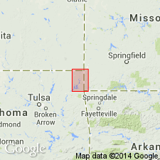
Named as a member (1 of 7) of Boone Formation; named for its occurrence in the quarry of the Joplin Marble Quarries Co., on the left bank of Shoal Creek half a mile or so below Grand Falls, 3 mi southwest of Joplin, Jasper Co, MO on the Ozark uplift (the type locality). Area of this report is in the Picher field, a great mining district which straddles the OK-KS State line just a few miles west of the MO State line on the Chautauqua platform and Cherokee basin. Consists of gray to brown, coarse- to fine-grained, crinoidal, fossiliferous, thick-bedded to massively bedded limestone and gray nodular or bedded chert; chert-free ledge near base. Chert may be in beds 6 inches to 3 ft thick, as lenticular nodules, or rounded nodules a few inches to 2 ft thick. Sparingly glauconitic. Chert nodules may be banded. Locally a little cotton rock. Thickness varies from 0-100 ft in the mining field; is 76 ft thick in a short steep gorge locally known as Wildcat Hollow; is 48 ft thick in a bluff on left side of Neosho River 2 mi southwest of Wyandotte; is about 10 ft thick in Tynon Bluffs. Conformably overlies Grand Falls Chert Member and disconformably underlies Short Creek Oolite Member, both of the Boone Formation. Abundant fossils (listed): corals, bryozoans, brachiopods, and rare mollusks and trilobites. Isopach maps; geologic map; cross section; stratigraphic table. Of Early Mississippian, Osage age.
Source: GNU records (USGS DDS-6; Denver GNULEX).
For more information, please contact Nancy Stamm, Geologic Names Committee Secretary.
Asterisk (*) indicates published by U.S. Geological Survey authors.
"No current usage" (†) implies that a name has been abandoned or has fallen into disuse. Former usage and, if known, replacement name given in parentheses ( ).
Slash (/) indicates name conflicts with nomenclatural guidelines (CSN, 1933; ACSN, 1961, 1970; NACSN, 1983, 2005, 2021). May be explained within brackets ([ ]).