

- Usage in publication:
-
- Jolliff member
- Modifications:
-
- Named
- Dominant lithology:
-
- Limestone
- AAPG geologic province:
-
- South Oklahoma folded belt
Summary:
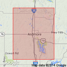
Named as basal member (of 5) of the Dornick Hills formation (new). Named from excellent outcrops in Jolliff Prairie, on the allotment of Norman Criner Jolliff, in sec 24, T5S, R1E, east of the axis of the Overbrook anticline, Carter Co, OK. Type locality designated near the center of SW1/4 NE1/4 NW1/4 sec 24, T5S, R1E. Occurs in the Ardmore basin of southern OK in the S. Oklahoma folded belt province. The lowest Pennsylvanian conglomerate occurs south of town of Ardmore as a minor local phase in association with Jolliff --a thin ledge of tan fossiliferous limestone. Is about 4 ft thick in the type locality, but the member tentatively correlated with it north of Ardmore attains a thickness of 10 to 15 ft. Overlies unnamed black shale of Springer formation; underlies unnamed shale of Dornick Hills. Otterville member (new) of Dornick Hills lies 300 to about 1,000 ft stratigraphically above the Jolliff. Fossil list; geologic map; columnar section. Of Pennsylvanian age.
Source: GNU records (USGS DDS-6; Denver GNULEX).
For more information, please contact Nancy Stamm, Geologic Names Committee Secretary.
Asterisk (*) indicates published by U.S. Geological Survey authors.
"No current usage" (†) implies that a name has been abandoned or has fallen into disuse. Former usage and, if known, replacement name given in parentheses ( ).
Slash (/) indicates name conflicts with nomenclatural guidelines (CSN, 1933; ACSN, 1961, 1970; NACSN, 1983, 2005, 2021). May be explained within brackets ([ ]).