- Usage in publication:
-
- Joliet limestone
- Modifications:
-
- Named
- Dominant lithology:
-
- Limestone
- Dolomite
- AAPG geologic province:
-
- Illinois basin
Summary:
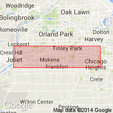
Named for Joliet, Will Co., northeastern IL. Includes all strata above weathered and pitted surface occurring 1 to 3 ft above STRICKLANDIA PYRIFORMIS zone up to near top of quarry of National Stone Quarry in Joliet. At quarry, consists of 1) 48 ft of yellowish-gray dolomite in rather thick layers 3 to 8 in thick and containing several discontinuous bands of chert in middle part; underlain by 2) 32 ft of gray to pink dolomite, somewhat granular, in thick layers, with greenish shale partings and, in upper part, a few thin bands of chert. As here defined, includes strata lower than any exposed in vicinity of Waukesha, WI. Overlies (probably unconformably) Kankakee (Brassfield) limestone; underlies, in Joliet region, a cherty limestone that is believed to correspond to Waukesha limestone of Waukesha, WI. In Jersey and Calhoun Cos. in southwestern IL, consists of 45 ft of yellowish-gray dolomitic limestone in layers 1 to 40 in. thick; overlies Kankakee (Brassfield limestone; underlies Devonian strata. In northwestern IL, consists of 30 to 38 ft of yellowish-brown dolomite overlying Kankakee (Brassfield) limestone and underlying Waukesha limestone. Correlates with Lockport dolomite.
Source: GNU records (USGS DDS-6; Reston GNULEX).

- Usage in publication:
-
- Joliet Formation
- Modifications:
-
- Overview
- AAPG geologic province:
-
- Illinois basin
Summary:
Joliet Formation is basal formation of Niagaran Series in area extending from Chicago to Calhoun Co is western IL. Thicknesses ranges from 70-80 ft along Des Plains River valley, 40 ft along Kankakee River, 35-40 ft along Mississippi River at Grafton in Jersey Co. Farther west, truncated by Middle Devonian strata; in southern Calhoun Co., formation is entirely eroded. In exposures in northeastern IL, along Des Plains, Kankakee, Du Page, and Rock Rivers, Joliet is divided into Brandon Bridge, Markgraf, and Romeo Members. Romeo Member is prominent in electric logs and has been traced widely in subsurface. Basal shaly zone of Joliet is characterized by abundance of arenaceous Foraminifera, among which Ammodiscidae are prominent. This zone is also present at base of Joliet in Jersey Co. and at base of St. Clair Limestone in southern IL. It has not been found in northwestern IL or in WI north of Milwaukee, but eastward it is well represented in Osgood Formation of IN. Outside the area where Joliet is subdivided, its top is not well established, but in northwestern IL, Marcus Formation may be in part equivalent to Joliet, and in southern IL, top of Joliet correlates to a horizon within St. Clair Limestone.
Source: GNU records (USGS DDS-6; Reston GNULEX).
For more information, please contact Nancy Stamm, Geologic Names Committee Secretary.
Asterisk (*) indicates published by U.S. Geological Survey authors.
"No current usage" (†) implies that a name has been abandoned or has fallen into disuse. Former usage and, if known, replacement name given in parentheses ( ).
Slash (/) indicates name conflicts with nomenclatural guidelines (CSN, 1933; ACSN, 1961, 1970; NACSN, 1983, 2005, 2021). May be explained within brackets ([ ]).

