- Usage in publication:
-
- Johnstons Camp rhyolite
- Modifications:
-
- First used
- Dominant lithology:
-
- Rhyolite
- AAPG geologic province:
-
- Snake River basin
Summary:
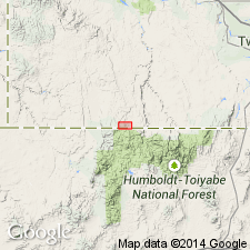
First published use. Authors state unit was named in unpublished thesis (Bernt, J., 1982, Univ of ID) for site in Indian Hay Meadows quad, south-central Owyhee Co, ID, Snake River basin. No type locality designated in this report. Generally poorly exposed, though occurs as lava flow with local domal forms at several places in upper Sheep Creek drainage in south-central part of quad. Probably is a continuous lava flow with limited areal extent and a local source. Consists of black vitrophyre, occurring at top and along margins of flow, and grayish-red lithoidal rhyolite occurring in flow interior. Complex joint patterns characterize some parts of unit. Unit is at least 60 m thick locally. Probably overlies Rough Mountain rhyolite (new); underlies Whiskey Draw tuff (first used) and Cougar Point Tuff. Geologic map. Chemical analysis. Miocene? age.
Source: GNU records (USGS DDS-6; Denver GNULEX).
For more information, please contact Nancy Stamm, Geologic Names Committee Secretary.
Asterisk (*) indicates published by U.S. Geological Survey authors.
"No current usage" (†) implies that a name has been abandoned or has fallen into disuse. Former usage and, if known, replacement name given in parentheses ( ).
Slash (/) indicates name conflicts with nomenclatural guidelines (CSN, 1933; ACSN, 1961, 1970; NACSN, 1983, 2005, 2021). May be explained within brackets ([ ]).

