The National Geologic Map Database is migrating to a new infrastructure. We apologize for any service disruptions during this process.
|
|---|


- Usage in publication:
-
- Johnson Gulch porphyry*
- Modifications:
-
- Named
- Dominant lithology:
-
- Porphyry
- AAPG geologic province:
-
- Eagle basin
Summary:
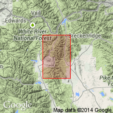
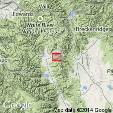
Named for typical exposures in Johnson Gulch, Leadville district, Lake Co, CO in the Eagle basin. No type locality designated. Is one of four named porphyries in the Gray porphyry group. Forms an extensive sheet above the White porphyry in the northwest part of the district. Forms a stock-like mass at Breece Hill. The porphyry is green gray to dark green. The lighter-colored varieties have lighter-colored biotite and little or no hornblende. In the darker-colored varieties, hornblende is present in the groundmass. Minerals in the porphyry are orthoclase, plagioclase, quartz biotite and hornblende with accessory magnetite, apatite, titanite, and allenite. The phenocrysts are plagioclase, a few large orthoclase crystals, quartz, biotite, and hornblende. Chemical analyses. Geologic map. Mapped with other porphyries of the Gray porphyry group which are assigned a Late Cretaceous or early Tertiary age.
Source: GNU records (USGS DDS-6; Denver GNULEX).
- Usage in publication:
-
- Johnson Gulch Porphyry*
- Modifications:
-
- Age modified
- AAPG geologic province:
-
- Eagle basin
Summary:
Age of Late Cretaceous or Paleocene accepted although attempts to date the porphyry have been unsuccessful. Is one of two principal porphyries of Leadville district in Eagle basin.
Source: GNU records (USGS DDS-6; Denver GNULEX).
- Usage in publication:
-
- Johnson Gulch Porphyry*
- Modifications:
-
- Geochronologic dating
- AAPG geologic province:
-
- Eagle basin
Summary:
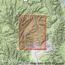
Has a 43.1 +/-4.3 Ma date obtained by the fission-track method on apatite and zircon. Is the youngest porphyry mapped. Cuts the Evans Gulch Porphyry at Breece Hill. Occurs in the Leadville district, Lake Co, CO in the Eagle basin, as a large stock beneath Breece Hill, as laccolithic extrusions northwest and southeast of Breece Hill stock, as dikes south and southwest of stock, and as a small stock in Iowa Gulch south of Breece Hill. Thin sills (50 m thick) of Johnson Gulch separate Chaffee Group from Leadville Dolomite along west margin of Leadville district. Geologic map. Of Tertiary age. [The one date from one sample is not conclusive enough to be used to assign a more specific age than Tertiary to the entire Johnson Gulch Porphyry according to Thompson, 2/2/89, oral communication.]
Source: GNU records (USGS DDS-6; Denver GNULEX).
For more information, please contact Nancy Stamm, Geologic Names Committee Secretary.
Asterisk (*) indicates published by U.S. Geological Survey authors.
"No current usage" (†) implies that a name has been abandoned or has fallen into disuse. Former usage and, if known, replacement name given in parentheses ( ).
Slash (/) indicates name conflicts with nomenclatural guidelines (CSN, 1933; ACSN, 1961, 1970; NACSN, 1983, 2005, 2021). May be explained within brackets ([ ]).