

- Usage in publication:
-
- John Muir Intrusive Suite*
- Modifications:
-
- Named
- Geochronologic dating
- Dominant lithology:
-
- Granite
- Granodiorite
- AAPG geologic province:
-
- Sierra Nevada province
Summary:
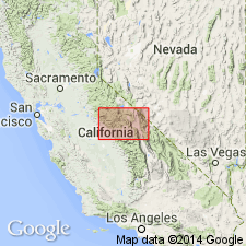
Named for exposures along John Muir trail which extends south from Yosemite Valley along crest of Sierra Nevada. Type area is between Mount Morrison roof pendant and Wheeler Crest and Pine Creek septa on east and Potter Pass septum on west. Formerly included Kaiser, Powell, and Mono Pass granitoid sequences of Stern and others (1981). Includes (oldest to youngest): Lamarck Granodiorites; Mount Givens Granodiorite; leucogranites of Big Sandy Bluff and Lion Point; leucogranodiorites of Burrough and Black Mountains; leucogranite of Bald Mountain; granodiorites of Red Lake, Eagle Peak, and Big Creek; Lake Edison Granodiorite (new); granite of Rock Creek Lake; Round Valley Peak Granodiorite; Mono Creek Granite (new); and Evolution Basin Alaskite (new). With exception of Mount Givens Granodiorite all larger plutons have long narrow shapes. U-Pb ages are about 90 Ma, thus Late Cretaceous.
Source: GNU records (USGS DDS-6; Menlo GNULEX).
For more information, please contact Nancy Stamm, Geologic Names Committee Secretary.
Asterisk (*) indicates published by U.S. Geological Survey authors.
"No current usage" (†) implies that a name has been abandoned or has fallen into disuse. Former usage and, if known, replacement name given in parentheses ( ).
Slash (/) indicates name conflicts with nomenclatural guidelines (CSN, 1933; ACSN, 1961, 1970; NACSN, 1983, 2005, 2021). May be explained within brackets ([ ]).