The National Geologic Map Database is migrating to a new infrastructure. We apologize for any service disruptions during this process.
|
|---|


- Usage in publication:
-
- Jobos Formation*
- Modifications:
-
- Named
- Dominant lithology:
-
- Breccia
- AAPG geologic province:
-
- Caribbean region
Summary:
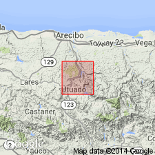
Named Jobos Formation for thick sequence of massively bedded volcanic breccia and associated rocks with an estimated thickness of 1700 meters. Lower contact is placed at base of lowermost massively bedded volcanic breccia that overlies relatively thin bedded volcanic sandstone and siltstone at top of Yunes Formation. This contact appears to be conformable, but locally it may be disconformable. Unit is overlain with angular unconformity by limestone of Oligocene age. Most exposures are in valley of Rio Grande de Arecibo, but inliers, probably exhumed buried hills, are present in area of Oligocene limestone. Probably Eocene. Map bracket shows upper Paleocene to middle Eocene and younger(?).
Source: GNU records (USGS DDS-6; Reston GNULEX).

- Usage in publication:
-
- Jobos Formation*
- Modifications:
-
- Age modified
- AAPG geologic province:
-
- Caribbean region
Summary:
The Jobos Formation occurs in central Puerto Rico and consists of volcanic breccia with some volcanic conglomerate, sandstone, and andesitic lava flows. Estimated thickness is 1700 meters. The age of the Jobos is changed to Oligocene and Eocene(?).
Source: GNU records (USGS DDS-6; Reston GNULEX).
For more information, please contact Nancy Stamm, Geologic Names Committee Secretary.
Asterisk (*) indicates published by U.S. Geological Survey authors.
"No current usage" (†) implies that a name has been abandoned or has fallen into disuse. Former usage and, if known, replacement name given in parentheses ( ).
Slash (/) indicates name conflicts with nomenclatural guidelines (CSN, 1933; ACSN, 1961, 1970; NACSN, 1983, 2005, 2021). May be explained within brackets ([ ]).