The National Geologic Map Database is migrating to a new infrastructure. We apologize for any service disruptions during this process.
|
|---|


- Usage in publication:
-
- Jesse James Canyon Tuff*
- Modifications:
-
- Original reference
- Dominant lithology:
-
- Tuff
- AAPG geologic province:
-
- Pedregosa basin
Summary:
Jesse James Canyon Tuff. [Called member 2 of Rhyolite Canyon Formation by Enlows (1955, GSA Bull., v. 66, p. 1215-1246).] Light-gray or pinkish-gray, typically lithic poor, moderately crystal rich (about 10 percent), biotite-bearing quartz-sanidine rhyolite ash-flow tuff from unknown source. Represents a simple cooling unit. Thickness 0 to 240 m. Correlative in part with welded tuff of Rucker Canyon of Drewes and Brooks (1988, USGS I-1827). Overlies Faraway Ranch Formation; disconformably underlies Rhyolite Canyon Tuff (restricted). Similar to middle and lower members of Rhyolite Canyon Tuff; distinguished from the Rhyolite Canyon by presence of trace biotite and sphene, absence of trace clinopyroxene, higher ratio of sanidine to quartz, less-evolved chemistry, and lower stratigraphic position. Age is Oligocene based on stratigraphic position.
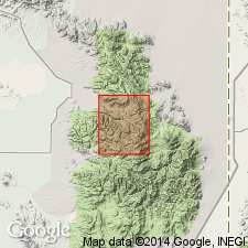
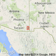
Type area: vicinity of Jesse James Canyon, Chiricahua National Monument and Coronado National Forest, near northern edge of Rustler Park quadrangle, Cochise Co., southeastern AZ. Named from Jesse James Canyon.
See also Pallister and others, 1992, USGS OFR-92-241.
Source: Publication.
- Usage in publication:
-
- Jesse James Canyon Tuff*
- Modifications:
-
- Geochronologic dating
- AAPG geologic province:
-
- Pedregosa basin
Summary:
Pg. 8 (table 2), 11, 53 (table 4). Jesse James Canyon Tuff. Samples from the Chiricahua Mountains area, Cochise County, southeastern Arizona, yielded 40Ar/39Ar ages (on sanidine) of 27.52 +/-0.06 Ma and 27.59 +/-0.06 Ma (table 2); 27.56 +/-0.04 Ma (table 4). [Age is late Oligocene (Chattian); Rupelian-Chattian boundary = 28.4 Ma (ICS time scale, ca. 2004).]
See also Pallister and du Bray, 1997, USGS I-2541, scale 1:24,000; du Bray and others, 1997, USGS I-2544, scale 1:50,000.
Source: Publication.
For more information, please contact Nancy Stamm, Geologic Names Committee Secretary.
Asterisk (*) indicates published by U.S. Geological Survey authors.
"No current usage" (†) implies that a name has been abandoned or has fallen into disuse. Former usage and, if known, replacement name given in parentheses ( ).
Slash (/) indicates name conflicts with nomenclatural guidelines (CSN, 1933; ACSN, 1961, 1970; NACSN, 1983, 2005, 2021). May be explained within brackets ([ ]).