The National Geologic Map Database is migrating to a new infrastructure. We apologize for any service disruptions during this process.
|
|---|


- Usage in publication:
-
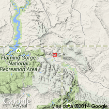
- Jesse Ewing Canyon Formation
- Modifications:
-
- Named
- Dominant lithology:
-
- Conglomerate
- Sandstone
- AAPG geologic province:
-
- Southern Rocky Mountain region
Summary:
Named for exposures at Jesse Ewing Canyon (type locality), northeast Daggett Co, northeast UT in Southern Rocky Mountain region. Is basal part of Uinta Mountain Group. Five type sections constitute stratotype in secs 36, T3N, R24E, sec 1, T2N, R24E, and in secs 6 and 7, T2N, R25E. Measured sections JE1-JE5 location and geologic maps. Individual measured sections range in thickness from 104-225 m. Is a sequence of interbedded dark-reddish-brown to dark-gray conglomerate with predominant white, pale-green, gray, or pink metaquartzite clasts, light- to dark-brown or reddish-brown sandstone and reddish-brown, red or maroon shale. Rapid lateral change in lithology. Angular unconformity between JE2 and JE3 separates older and younger sequences. Younger sequence now faulted by syn- and post-depositional displacement and overlies Red Creek Quartzite. Overlain by Uinta Mountain Group (undivided). Has no exposed equivalent in western part of Uinta Mountains, although equivalent strata may be present in subsurface. Top taken to be top of uppermost major shale bed or top of uppermost major conglomerate bed where shale is thin or absent. Base taken to be major nonconformity at top of Red Creek Quartzite. Divided into 7 facies types and interpreted to be product of alluvial fan deposition that developed through time along active fault system. Photographs, sedimentologic descriptions. Middle Proterozoic on basis of relative stratigraphic position.
Source: GNU records (USGS DDS-6; Denver GNULEX).
For more information, please contact Nancy Stamm, Geologic Names Committee Secretary.
Asterisk (*) indicates published by U.S. Geological Survey authors.
"No current usage" (†) implies that a name has been abandoned or has fallen into disuse. Former usage and, if known, replacement name given in parentheses ( ).
Slash (/) indicates name conflicts with nomenclatural guidelines (CSN, 1933; ACSN, 1961, 1970; NACSN, 1983, 2005, 2021). May be explained within brackets ([ ]).