The National Geologic Map Database is migrating to a new infrastructure. We apologize for any service disruptions during this process.
|
|---|


- Usage in publication:
-
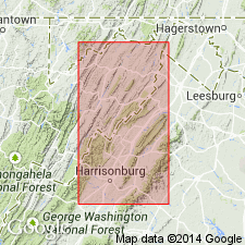
- Jennings formation*
- Modifications:
-
- Named
- Dominant lithology:
-
- Shale
- Sandstone
- AAPG geologic province:
-
- Appalachian basin
Summary:
Named the Jennings formation in northern VA, eastern WV, and MD for Jennings Gap, Augusta Co., VA. Consists of light-colored olive, gray, and buff shale with interbedded light-colored sandstone. Locally, sequence is variable, but middle part consists largely of arenaceous beds. Contains fossils that are also found in the Chemung and Portage formations, and also probably contains beds equivalent to the Hamilton. Thickness is 2,800 to 3,200 feet. Overlies the Romney shale and underlies the Hampshire formation. The Jennings is of Late Devonian age.
Source: GNU records (USGS DDS-6; Reston GNULEX).
For more information, please contact Nancy Stamm, Geologic Names Committee Secretary.
Asterisk (*) indicates published by U.S. Geological Survey authors.
"No current usage" (†) implies that a name has been abandoned or has fallen into disuse. Former usage and, if known, replacement name given in parentheses ( ).
Slash (/) indicates name conflicts with nomenclatural guidelines (CSN, 1933; ACSN, 1961, 1970; NACSN, 1983, 2005, 2021). May be explained within brackets ([ ]).