

- Usage in publication:
-
- Jelm formation*
- Modifications:
-
- Overview
- Dominant lithology:
-
- Sandstone
- AAPG geologic province:
-
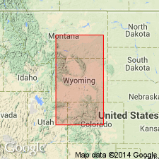
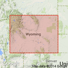
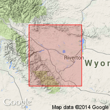
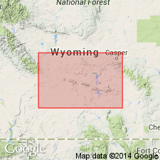
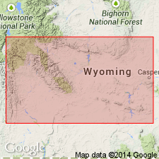
- Green River basin
Summary:
Name attributed to an abstract by Knight (1917, GSA Bulletin 28, no. 1, p. 168) who named it for exposures near east base Jelm Mountain (its type locality) in the Laramie quad, Albany Co, WY in the Greater Green River basin. Consists chiefly of orange sandstone. Is unconformable on unnamed redbeds of Triassic age. Unconformably overlain by Sundance formation. Is 250 ft thick at Jelm Mountain; is 355 ft thick at Alcova; is 73 ft thick at Casper. Has bones of Triassic vertebrates in pebble conglomerate (small limestone pellets, wood fragments, etc.) beds. The lime pebble conglomerates occur near Rawlins, Whiskey Gap, near Lander, near Alcova, and Casper Mountain, but they do not occur near Thermopolis. Jelm probably represented in the Laramie Range, WY and Front Range, CO. Probably a stream channel deposit and as such may be discontinuous. Cross section. Triassic age.
Source: GNU records (USGS DDS-6; Denver GNULEX).
- Usage in publication:
-
- Jelm formation
- Modifications:
-
- Revised
- AAPG geologic province:
-
- Green River basin
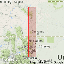
- North Park basin
Summary:
The former Jelm formation of southeastern WY was divisible into 3 parts. The two lower parts --called the lower and upper members of the Jelm are retained in the Jelm in this report. An upper part is removed and reassigned to the Nugget sandstone. The stratigraphically restricted Jelm was studied in the area from Bull Mountain, sec. 9, T 11 N, R 76 W, Larimer Co., CO in the Denver basin north into Albany and Carbon Cos., WY to the Freezeout Hills in the Greater Green River basin. Measured sections. Cross sections. History of nomenclature chart. The lower member disconformably overlies the Alcova limestone member of the Chugwater formation in the Freezeout Hills and an unnamed part of the Chugwater south of the Freezeout Hills. The lower member ranges between 135 to 164 ft thick and consists of pink to white to purple, very fine to fine grained sandstone and red-brown noncalcareous shale. The disconformably overlying upper member is conglomeratic, has gray, very fine to coarse grained, lime cemented cross-bedded sandstone, and varies between 5 and 50 ft thick in the north, and between 24 and 49 ft thick in the south. The upper member is well cemented, cross-bedded, and makes slabby ledges or prominent ridges. Conglomerate in the upper member varies between 4 inches and 1 ft thick; it is composed of subround to well rounded pebbles, cobbles, and boulders of sandstone, siltstone, claystone, limestone in a matrix of calcareous green clay, siltstone, and fine to very coarse sandstone. The lower member may be of eolian origin. The upper member may be a fluviatile deposit.
Source: GNU records (USGS DDS-6; Denver GNULEX).
- Usage in publication:
-
- Jelm Formation
- Modifications:
-
- Overview
Summary:
Popo Agie Member of Chugwater Formation divided into four informal units, in ascending order: lower carbonate unit, purple unit, ocher unit, and upper carbonate unit. Lower carbonate, purple, and ocher units may extend into southeastern WY [exact location not specified; probably Greater Green River and Denver basins] where they are lateral equivalents of upper part of Jelm.
Source: GNU records (USGS DDS-6; Denver GNULEX).
- Usage in publication:
-
- Jelm Formation*
- Modifications:
-
- Revised
- Reference
- AAPG geologic province:
-
- Green River basin
Summary:
Assigned to Chugwater Group (rank raised) as one of four formations. Some of the rocks called Jelm were assigned to Crow Mountain Sandstone Member, Popo Agie Member, or an unnamed part of Chugwater in earlier reports. Is equivalent to Crow Mountain Sandstone (rank raised) used northwest of Granite Mountains. Jelm is used southeast of Granite Mountains in Carbon Co, Greater Green River basin. Divided into Red Draw (base) and Sips Creek (top) Members, both newly named. Reference section designated at Red Mountain in sec 16, T12N, R76W, Albany Co, WY in Denver basin. No description of reference section given. Ranges from 25 ft thick near Casper to 360 ft thick near Sips Creek. Averages 225 ft thick. Overlies Alcova Limestone (rank raised) of Chugwater. Underlies Canyon Springs Sandstone Member of Sundance Formation at some localities or Popo Agie Formation (rank raised) of Chugwater at other localities. Of Triassic age. Cross sections.
Source: GNU records (USGS DDS-6; Denver GNULEX).
- Usage in publication:
-
- Jelm Formation
- Modifications:
-
- Revised
- Overview
- Age modified
- AAPG geologic province:
-
- Yellowstone province
- Wind River basin
- Green River basin
Summary:
Throughout central WY Jelm disconformably overlies Crow Mountain Formation. Jelm and Crow Mountain are assigned to Chugwater Group. East of Muddy Gap (sec 2, T27N, R89W, Carbon Co, Greater Green River basin) upper two units ("basal" sandstone and upper sandstone and siltstone units) of Crow Mountain grade laterally into basal Jelm. Several miles east of Freezeout Mountains (Carbon Co) Alcova Limestone Member (revised) of Jelm is absent and Jelm overlies Red Peak Formation of Chugwater. East of Happy Spring (sec 12, T28N, R95W, Fremont Co, Wind River basin) thickness is 200-300 ft; thins abruptly to west averaging 100 ft thick between Happy Spring and Red Grade (sec 13, T5N, R6W, Fremont Co, Wind River basin); rocks now included with Jelm in western area were referred to as unnamed redbed unit by High and Picard (1967). [Redbed unit shown on fig 2 as lower part of Popo Agie Formation of Chugwater Group.] In western WY, in area of Red Mountain, Jelm tongue grades into basal part of Ankareh Formation and consists of dark reddish-brown, platy, calcareous siltstone and very fine to fine grained sandstone with abundant small-scale cross-stratification and ripple marks. Conformably underlies Popo Agie Formation of Chugwater. Correlation chart; cross sections. Assigned Early and Middle? Triassic age; age assignment probably based on correlations.
Source: GNU records (USGS DDS-6; Denver GNULEX).
- Usage in publication:
-
- Jelm Formation*
- Modifications:
-
- Areal extent
- AAPG geologic province:
-
- Denver basin
Summary:
Red Draw Member of the Upper Triassic Jelm Formation [only part of Jelm shown] extends from south of Horse Creek, Laramie Co, WY to Little Thompson, Boulder Co, CO, all in Denver basin. Wedges out between Horse Creek and Mesa Mountain in WY and between Little Thompson and Four Mile Canyon in CO. Measured sections shown graphically. Underlies Sundance Formation unconformably. Overlies Lykins Formation unconformably in CO and Red Peak Formation of Chugwater Group in WY.
Source: GNU records (USGS DDS-6; Denver GNULEX).
For more information, please contact Nancy Stamm, Geologic Names Committee Secretary.
Asterisk (*) indicates published by U.S. Geological Survey authors.
"No current usage" (†) implies that a name has been abandoned or has fallen into disuse. Former usage and, if known, replacement name given in parentheses ( ).
Slash (/) indicates name conflicts with nomenclatural guidelines (CSN, 1933; ACSN, 1961, 1970; NACSN, 1983, 2005, 2021). May be explained within brackets ([ ]).